
 Yahoo Movies
 New York City is on the verge of its all-time longest snow drought
New York City is on the verge of notching its longest-ever streak without measurable snowfall.
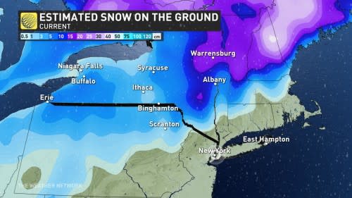
The city that never sleeps hasn’t seen a measurable snowfall since March 9, 2022, when a single centimetre of snow fell at Central Park. The 320+ days since that last snowfall is steadily creeping up the list of the lengthiest snow-free streaks in New York City’s long history.
The city’s all-time snow drought happened just a couple of years ago, when Central Park went about 11 months without snow between January and December 2020.
During an average winter, New York City would typically see its first measurable snow in the first week of December.
This current streak will claim the top spot if they make it to the end of the month without any measurable snowfall.
That’s no small feat considering the depth of New York’s weather records.
Most cities around the U.S. and Canada have reliable weather records that only stretch back to the early- to mid-1900s. NYC’s Central Park, however, has one of the world’s longest meteorological paper trails.
Daily observations began in Central Park in 1869—four years after the end of the American Civil War and four decades before the Ford Model T heralded the start of the motor vehicle era. That’s more than a century and a half of data, making all-time records here all the more impressive.
Official records are also kept at the city’s two major airports. Snowfall records began at LaGuardia Airport in 1940, and at John F. Kennedy Airport in 1948. If this snow-free streak reaches the end of the month, it’ll claim the top spot at both of those airports, as well.
WATCH: What, exactly, is a weather bomb?
Why have the 8.4 million people who call New York City home seen such rainy weather this winter? For much the same reason that Halifax recently endured a historic snow drought, it’s all about the storm track.
Most of the storms that have hit the U.S. East Coast this year tracked far inland, bringing snow to the Great Lakes and interior New England instead of scooting up the coast.
MUST SEE: ‘Weather bombs’: Explosive storms that create ferocious conditions
This inland storm track has prevented those classic nor’easters from roaring up the Interstate 95 corridor, leaving cities from Washington to Boston in an unusual wintry lull.
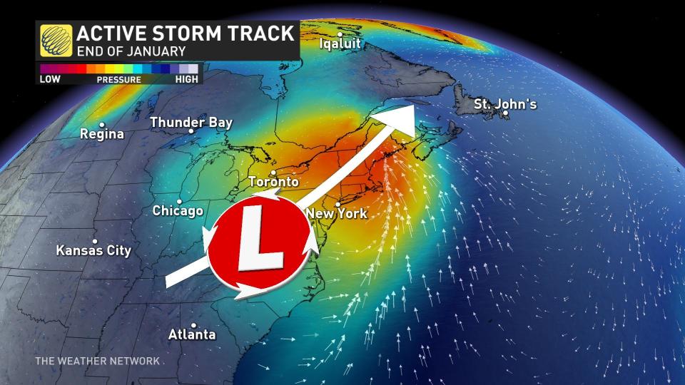
A pattern change heading toward the eastern half of North America next week could break this streak just in the nick of time.
An active storm track along the East Coast, combined with cold air filtering south from the Arctic, could provide one or more opportunities for snow to reach this American megalopolis.
However, it’ll be a close call, and the influence of the ocean often keeps conditions just a little bit too warm for snow in these dicey, marginal setups.

