
 Yahoo Movies
 UK weather: Torrential rain ends heatwave for south as flash flood reported in Kent
Residents of a Kent town took to social media last night amid thunderstorms and heavy rains, following a spell of hot weather across much of England and Wales.
ITV News reporter James Dunham shared photos of a flash flood on Hythe High Street at 11.30pm, where water can be seen covering the entire road, with residents walking in water up to their ankles.
Flash flooding on Hythe High Street in Kent this evening. Feels like it's going to be a very stormy night. pic.twitter.com/Ebp79wY9z8
— James Dunham 📺🎥👨🏻💻 (@jamesjdunham) June 16, 2021
Others shared videos and comments about the torrential downpour.
Down the seafront between Folkestone and Hythe on the beach, the wind started howling then the heavens opened. Nearly drowned getting back to the car pic.twitter.com/PGBjuvkrmy
— CheritonWeather CT19 (@CheritonWeather) June 16, 2021
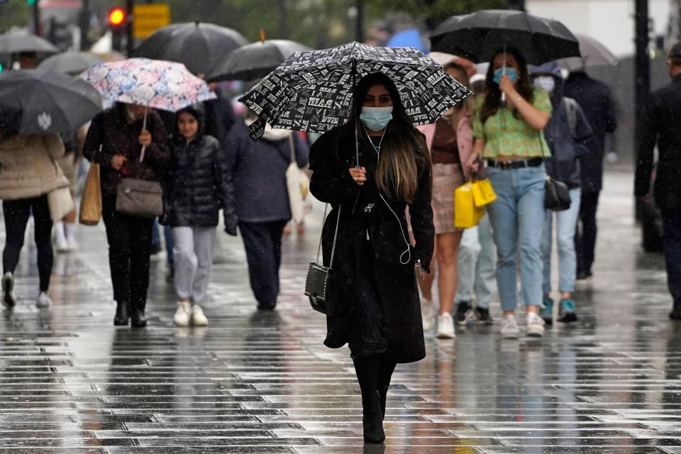
Thunderstorms moved across the English Channel and into the UK overnight, with much of the country seeing strong winds, rain, and lightning, and even flash flooding in some areas.
Earlier this week, the Met Office issued yellow thunderstorm warnings for much of England and Wales, forecasting that some areas could see up to 50mm of rainfall within a period of two to three hours — the equivalent of a month’s worth of rainfall.
These levels could lead to flooding as well as power outages in some areas and could leave some communities isolated due to flooded roads.
Tankers and sandbags were on standby across Kent overnight, as the county was preparing for intense thunderstorms and flash flooding.
Earl Bourner, Drainage and structures asset manager at Kent County Council warned that drainage systems may not be able to cope with the levels of rain that the Met Office had predicted, Kent Online reported.
“This level of rainfall in a short period of time really will impact drainage systems and these will surcharge which will lead to flooding problems on the network,” he said.
“It’s been very dry so the ground isn’t going to soak the water as much so this could also deflect off and lead to further issues for us.”
He warned that driving conditions could be “quite hazardous” during the storms, and urged those who needed to drive to do so carefully, leaving enough braking distance between cars and reporting any hazards to Kent County Council.
Mr Bourner added that although flood management tended to be reactionary, that it was important for people to be aware of flood risks in their area.
“You can’t put all of the resources everywhere and we almost have to react after the incident. “But it’s mindful for people who do know they’re in prone flood areas to maybe get ahead of the game. Look to see if the gullies in their road are clear, report them to us if they’re not and possibly think about some kind of flood protection for their own property.”
Tankers, sandbags and 24 out of hours officers have been waiting on standby to respond to any flooding.
The town of Hythe in Kent is at a particularly high risk in heavy storms, as more than half of the homes in the Folkestone and Hythe District Council are at risk of flooding, according to the local council.
The council has been contacted for comment.
On Thursday morning the Met Office updated the thunderstorm warnings, downsizing the affected zone to a smaller area around London and the south east.
“The remnants of overnight showers and thunderstorms will tend to fade away this morning. Then, during the afternoon, there is a chance that thunderstorms may develop again over parts of East Anglia and, perhaps, the far southeast of England.
“Whilst most places will miss thunderstorms today, where they do occur torrential rain, frequent lightning and strong gusty winds are possible.
“Rainfall totals of 20 to 30 mm could fall in an hour, with a few locations perhaps receiving around 50 mm in two or three hours”
The Met Office says there is some possibility of intense storms again on Friday, with heavy rainfall before the storms are expected to clear into the North Sea on Saturday morning.
“Another spell of thundery rain is expected to push north across England and east wales through Friday morning.
“There is some uncertainty in storm coverage, particularly western extent, but where they do develop torrential rain, intense thunderstorms, hail, and frequent lightning are all possible.
“Rainfall totals of 20-40mm, perhaps 60mm in a few areas, are possible in 12 hours. With the most intense storms, 30-40mm could fall in an hour or two.
“The storms should clear into the North Sea during Saturday morning.”
Read More
UK weather: The latest Met Office forecast
UK weather: Two more days of hot sunshine – then thunderstorms
UK records hottest day of 2021 so far as temperatures hit 28.6C
