Yahoo Movies
 One tropical disturbance near Florida, one headed for the Caribbean. Here’s what we know
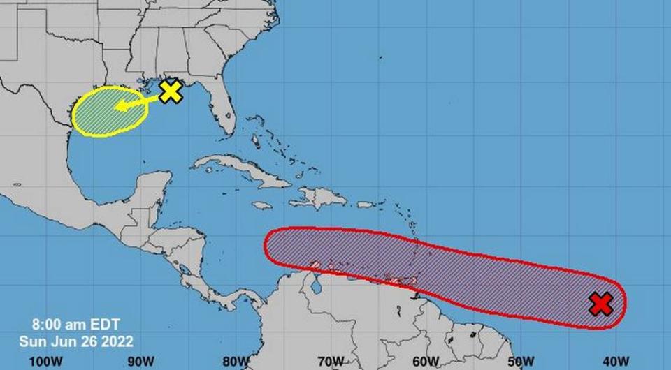
Two disturbances with very different chances of turning into anything more disturbing, according to the National Hurricane Center’s 8 a.m. Sunday update., are in the Atlantic Ocean and the Gulf of Mexico.
Disturbance No. 1 is in the Central Atlantic and has a 80% chance of forming into a cyclone over the next five days. It’s expected to move west at 15 to 20 mph and its conical track includes Barbados, Trinidad and Tobago, Grenada, Martinique, St. Lucia, St. Vincent and the Grenadines and northern Venezuela.
“Environmental conditions appear conducive for development of this system over the next few days, and a tropical depression could form during the early to middle part of this week,” the NHC said.
Disturbance No. 2, bringing thunderstorms from southeastern Louisiana to the southern edge of the Florida panhandle, has only a 20% chance of cyclone formation over the next five days.
“Development of this system is expected to be slow to occur as it drifts westward across the northern Gulf of Mexico over the next few days,” the NHC said.