
 Yahoo Movies
 Ten years of the Wales Coast Path: a walk around the Llŷn peninsula
Porth Neigwl beach, between the craggy headlands of Mynydd Rhiw and Mynydd Cilan at the end of north Wales’s Llŷn peninsula, is known as Hell’s Mouth, because locals once used its rough waters as a “trapping bay”, luring ships into it then murdering their crews and stealing their cargo. I feel quite safe there today, though, as I climb over grassy dunes and across the soft clifftops of boulder clay, remnants of the last ice age.
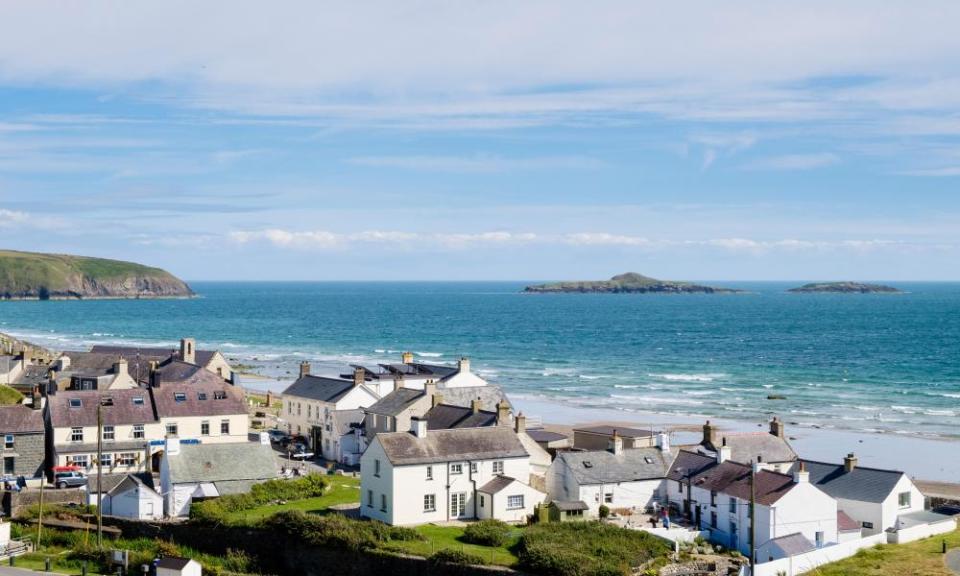
I’m walking around the peninsula on one of the lesser-known sections of the Wales Coast Path – which celebrates its 10th anniversary this year – basing myself in the fishing village of Aberdaron.
Wales was the first country to create a walking route around its entire coastline – 870 miles beginning near Chester and leading down to Chepstow. The path, which opened in May 2012, passes through 16 local authorities and two national parks and is a lifeline for local communities, with walkers visiting the many independent shops, hotels pubs and restaurants along the coastline. Mark Drakeford, the Welsh first minister, called it “one of the crowning glories of Wales”.
To complete the route in one go would mean more than 10,000 metres of ascent and descent – a little more than the height of Everest – and would take around three months. Few have managed this feat, though Sarah Williams, host of the Tough Girl podcast, is hoping to finish the circuit in 50 days.
Having no such ambitions, I make my leisurely way to the north-western edge of Porth Neigwl and the National Trust-owned Plas yn Rhiw, a 17th-century manor house with views across Cardigan Bay. I walk through a maze of magnolias, camellias and daffodils in the upper woodland, and primroses by the millpond. In the 20th century, the house was rescued from neglect and lovingly restored by three environmentally minded sisters, the Keatings, who left rooms lavishly decorated with Dutch mahogany, fine Japanese woodcuts and Viennese vases.
Related: Eccentric poets, exotic flora and wild seas: a car-free break on the Llŷn peninsula
From the house, I hike on towards 177-metre Penarfynydd hill, passing the Nant y Gadwen manganese mine, the secluded cove of Porth Ysgo, and the rocky headland of Trwyn y Penrhyn on my way to Aberdaron, where I settle into the Ship Hotel (doubles from £90 B&B).
I am woken by the sound of seagulls and set off on a slight detour, boarding the daily boat trip to the holy island of Bardsey from Porth Meudwy, a mile or so round the bay. This is an ancient pilgrimage route: in the early middle ages, three pilgrimages to Bardsey, “Isle of 20,000 Saints”, were said to equal one to Rome. We bounce across the choppy waves of Bardsey Sound, spotting Risso’s dolphins and porpoises before landing to a welcoming committee of nearly 200 Atlantic grey seals, barking and lapping up the sun on the rocky shore.
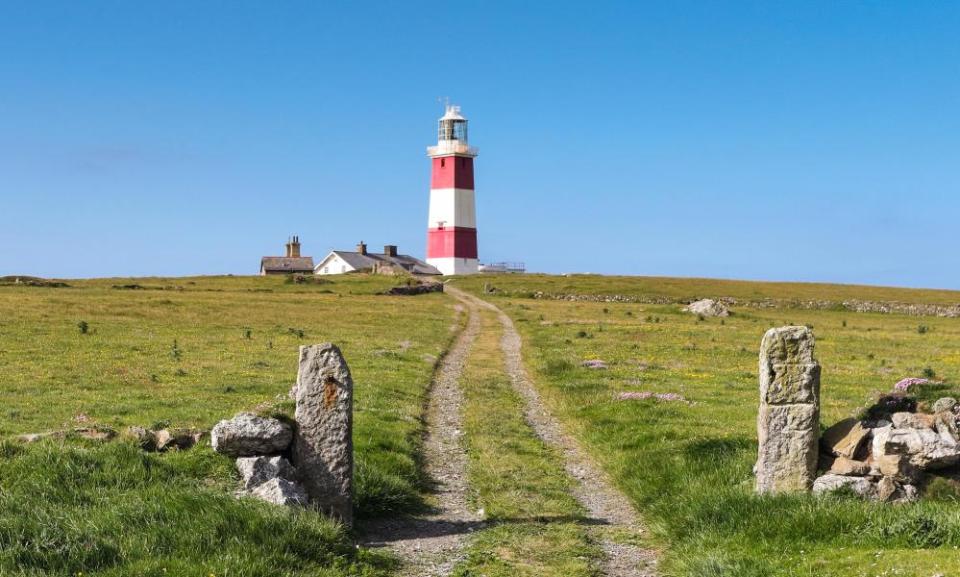
Bardsey is a designated Special Area of Conservation and Special Protection Area, and sits on a key migratory route for birds including choughs, oystercatchers, peregrine falcons, gannets and razorbills. It’s also the site of the ruined Saint Mary’s Abbey, and a 167-metre peak, Mynydd Enlli, which I climb through shrouds of mist before heading down to Bardsey Lighthouse, the tallest square-towered lighthouse in the UK.
Back at Porth Meudwy, I follow the coastal path to Porth Felen, almost at the end of the peninsula, and surrounded by wildflowers from thrift to rockrose, sea squill and campion. I scramble down the cliffs to take the stepping stones to Saint Mary’s well, where I sip its fresh, healing waters before returning to the Ship for a not-so-holy glass of merlot.
Next morning, I walk north across the peninsula to Porthor, known for its squeaky “whistling” sands and on to Porth Iago Beach, a sandy cove where local fishers catch bass. At the fishing village of Porthdinllaen, the waters lap against stout stone houses and pints are pulled in the Ty Coch Inn, right on the beach. I hop over rock pools and head for the clifftops of Nefyn, nudging down a steep path to a valley enclosing Nant Gwrtheyrn, a former quarry village that’s now home to the National Welsh Language and Heritage centre.
I make another little diversion across boggy ground to the iron age hillfort of Tre’r Ceiri (town of giants), which offers sweeping views over the Isle of Anglesey. I still have 14 miles to go before finishing my walk at Caernarfon Castle. When the Wales Coast Path was first opened in 2012, walkers were invited to “discover the shape of a nation”. And in a recent interview celebrating the anniversary, Paddy Dillon, who wrote the guidebook to the route, said: “Quite apart from just clocking off the miles along the coast, I would say to anybody be sure to take in the history and heritage as you’re travelling.”
Travel and accommodation were provided by Visit Wales and Wales Coast Path. National Rail has advance tickets from London to Bangor from £32 each way.

