
 Yahoo Movies
 NSW floods: Sydney braces for two more days of flooding as state smashed by rain and wind
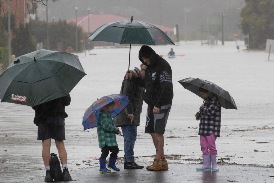
The New South Wales State Emergency Service reported more than 5,300 requests for assistance on Monday night, including 252 flood rescues, mainly of drivers stuck in cars and residents needing to be relocated.
Related: Efforts to move cargo ship stranded off Sydney suspended after tow lines snap in wild weather
The wild weather continued in NSW through the night, with heavy rain and strong winds lashing the state.
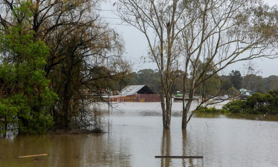
Scores of evacuation orders were issued, mostly north-west of Sydney, where major flooding occurred along the Hawkesbury and Nepean rivers at Menangle, North Richmond, Lower Portland and Windsor.
Following massive rainfall totals across multiple catchments over the past three days, some areas were expected to approach or exceed the flood levels of March 2021, and March and April of this year.
Residents in parts of Chipping Norton in Sydney’s south-west were ordered to evacuate before midnight, with flood warnings for the Georges and Woronora rivers.
Camden, in Sydney’s far south-west, received 197.4mm for the month to date, with residents enduring their fourth flood already this year.
default
The Hawkesbury River at North Richmond was expected to remain above 14m until Tuesday morning, with major flooding forecast. The Upper Nepean River at Menangle peaked at 16.61 metres on Sunday morning.
Gale warnings remained current for the Hunter coast and Sydney coast, as well as strong wind warnings for Sydney’s enclosed waters, and the Macquarie, Illawarra, and Batemans coasts.
The NSW SES deputy commander, Ashley Sullivan, told the ABC the risk to homes and to lives would persist on Tuesday and into Wednesday.
“Certainly with the persistent rain we are receiving, the threat will remain into today and tomorrow. Even when it does stop raining, the flood threats will continue, and particularly into the Hunter Valley where it is currently raining at the moment.
“We are paying particular attention as to what will happen over the next 48 hours, particularly on the Hunter River system as we start to see the rivers rise up there.”
There are 60 evacuations current, Sullivan said.
Related: Lismore’s residents are living in limbo on the frontlines of the climate emergency
“The majority are in the Hawkesbury, Nepean, Georges and Woronora River system. Today those residents under that warning, we are asking them to prepare to evacuate.
“Wherever possible, review your flood plan, head over to friends’ or family’s and keep yourself safe. Particularly for motorists, please stay off the roads today … stay at home wherever possible.”
Sullivan warned “this system will not diminish today or tomorrow particularly on the Hawkesbury-Nepean system, the flood threats remain”.

All major dams in the Sydney network were continuing to overflow, but at a slower rate than on Sunday.
The spill rate from Warragamba dam had fallen from a high of 515 gigalitres – equivalent to one Sydney Harbour – a day on Sunday afternoon to 380 on Monday.
Some 200 Australian defence force troops and two helicopters had been deployed to support the flood effort, while more may be required to assist in clean-up efforts.
SES volunteers have worked more than 10,000 hours since Friday, while more than 1,000 were on the ground on Monday afternoon supported by police and emergency services.
The emergency services minister, Murray Watt, told the ABC financial assistance including disaster payments would be on the table once NSW formally declared a state of emergency, expected to happen “imminently”.
“This is a terrible thing for anyone to have to go through just once, let alone four times in 18 months. So I’m not surprised to hear that people are at breaking point,” he said.
default
Greg Mullins, the state’s former fire and rescue commissioner, said the backdrop to La Niña, El Niño and the string of recent floods was climate change.
In the past 18 months, Australia’s east coast has experienced four major floods, while Sydney is in the midst of its wettest year to date with almost 1,700mm so far in 2022.
Mullins said the “frequency and intensity” of natural disasters was changing.
“Just as you’re recovering from the last disaster another one comes along and knocks you off your feet,” he said.
“The best recovery comes from the local community, but if they’re repeatedly hit hard, the concept of resilience starts to go out the window – it’s just too bloody hard.
“Rainfall now comes in short, sharp bursts rather than long gentle periods, so we’re overwhelmed. This is climate change in action.”
Mullins said he was buoyed the new government had expressed a willingness to listen to experts, which would be key in the recovery phase.
“We have to adapt to climate change as best we can and it’s going to be very expensive because we’ve undercooked emergency service funding and recovery,” he said.
“A good place to start is to stop paying subsidies to the fossil fuel industry.”
