
 Yahoo Movies
 Slick roads likely as snow continues into Saturday for B.C.
Our latest round of wintry precipitation will continue across southern British Columbia overnight Friday into Saturday morning. While it’s much less snow than we saw earlier in the week, it’ll be enough to hamper travel across parts of the Lower Mainland and Vancouver Island.
__Visit our Complete Guide to Winter 2022/23 for an in-depth look at the Winter Forecast, tips to plan for it, and much more!
This second round of snow comes courtesy of a broad low spinning off the B.C. coast. This precipitation will continue through the nighttime hours before tapering off in the morning.

Anyone commuting late into the evening should exercise caution as the snow and ice will lead to slick roads.
By the time all is said and done on Saturday, the Lower Mainland stands to receive up to 5 cm of additional snowfall. The greatest totals are reserved for central Vancouver Island, where some areas could see 10+ cm of snow by Saturday morning.
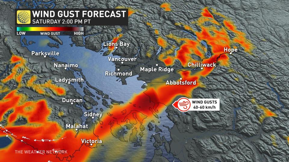
In addition to the snowfall, gusty conditions will make for a windswept Saturday for parts of southern B.C. Some communities could see wind gusts of 40-60 km/h through the afternoon hours as the system pulls away from the province.
Temperatures will remain on the brisk side of seasonal heading into the first full week of December, with daytime highs in the lower single digits likely for much of southern B.C. through the foreseeable future.
Stay tuned to The Weather Network for the latest on conditions across B.C.

