
 Yahoo Movies
 B.C.'s South Coast braces for Arctic chill and hefty snow
Widespread special weather statements are in effect across the South Coast of British Columbia as confidence builds for an impactful winter storm this week.
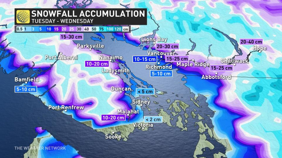
Parts of the Lower Mainland will face their first significant snowfall of the season on Tuesday and Wednesday due to a low-pressure system interacting with an Arctic outflow, which will also bring frigid temperatures and gusty winds.

While B.C. has seen several snow events in higher terrain, some areas like Burnaby and eastern areas of Vancouver Island have only had light snowfall accumulations so far this season.
"It is now time for Vancouver and Abbotsford to see their first major snowfall of the season," says Matt Grinter, a meteorologist at The Weather Network. "Confidence is pretty high that this will be a significant snowfall event for parts of the Lower Mainland."

Snow will move in late-day Tuesday, becoming heavy for Metro Vancouver in the late-evening hours. Some coastal mixing will be possible early Wednesday morning, but heavy snow continues inland and at higher elevations.
Totals across Metro Vancouver will range from 10-20+cm, with 20-30+cm for the Fraser Valley.
Places like Richmond and Delta are forecast to see the lowest accumulations from 5-10 cm.
Related: Simple tricks for effectively priming your car for winter driving
There will also be heavy snow for the alpine regions and difficult travel conditions across the Interior, with 10-15 cm anticipated for the Okanagan Valley.
WATCH: Snowiest November day since 2006 across Vancouver Island possible
"East Vancouver Island will vary greatly, as well," adds Grinter. "Victoria could see some flurries with no accumulations, where as the Malahat could see 10-20 cm along with areas along the Trans-Canada and Highway 19."
Some shoreline areas near Nanaimo, Ladysmith and Duncan may see just 5-10 cm.
Wind gusts could reach 90 km/h by Tuesday evening, especially in the Strait of Georgia. Combined with snow-loaded branches, this may result in power outages.
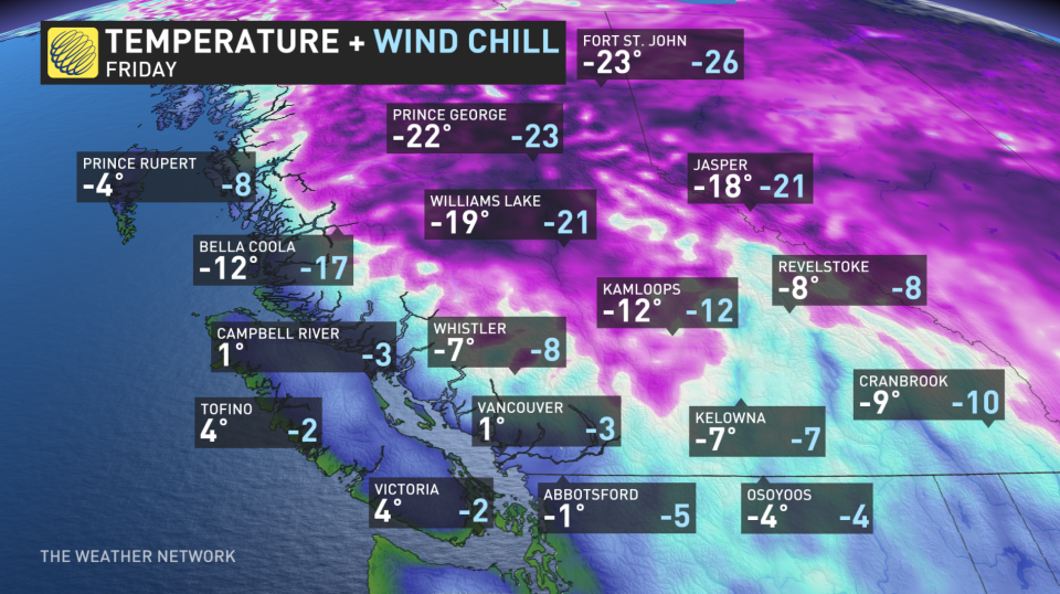
Cold, Arctic air will continue to push south into the Interior, as well. Falling temperatures over the next couple of days are expected as brisk outflow winds develop.
Be sure to check back frequently to The Weather Network for updates as this system has the potential to be a high-impact weather event.
Thumbnail courtesy of @ParksvilleWX/Twitter.

