
 Yahoo Movies
 National Trust maps ‘worst case’ climate impacts on heritage and landscapes
The National Trust has drawn up a “game changer” climate change map plotting possible threats to its stately homes, landscapes and coastline.
The mapping tool outlines threats posed by climate impacts including extreme heat and humidity, landslides, high winds, and floods, and how they could change by 2060.
Its map is based on a “worst-case scenario” of a failure to drive down carbon emissions over the coming decades, intended to be a flagging tool to highlight potential hazards in the area of a heritage site.
It reveals that, without action on emissions, the number of National Trust sites in areas at the highest threat level from climate impacts could more than treble from 3,371 (5 per cent) to 11,462 (17 per cent) over the next 40 years.

And the number of sites at high or medium risk of climate-related hazards could increase from 20,457, or 30 per cent of sites, to 47,888, or 71 per cent, by 2060.
Identifying areas at risk will help the National Trust pinpoint locations that could need interventions such as planting trees or restoring peat bogs to hold or slow the flow of water to prevent flooding, or more shade to protect areas at risk of high temperatures.
The map will ensure that, under a commitment to plant or establish 20 million trees to tackle climate change, trees go in the places they are needed most, the charity said.
The map shows high heat and humidity will hit the south-east of England, with a third of National Trust sites in the region experiencing at least 15 days above 30C (86F) a year, and storm damage, landslides and flooding will become common and more widespread, particularly in the North of England and Wales.
Coastal erosion and flooding will increase in Northern Ireland, potentially leading to more landslides around locations such as the Giant’s Causeway.

National Trust director for land and nature Harry Bowell said: “This map is a game changer in how we face the threat climate change poses to the places we care for.
“While the data draws on a worst-case scenario, the map paints a stark picture of what we have to prepare for.
“But by acting now, and working with nature, we can adapt to many of these risks.”
The National Trust is working in partnership with government bodies to plot all cultural heritage sites in the UK, and has unveiled the map ahead of key UN climate talks in Glasgow to drive international action on climate change – which if successful would avoid the worst case scenario in the map.
The Trust says staff are already taking action to cope with rising temperatures, such as at Ham House in London, which could often face 40C (104F) heat by 2040, where heat-tolerant plants are being grown and garden working hours have shifted to start and finish earlier to avoid summer afternoon heat.
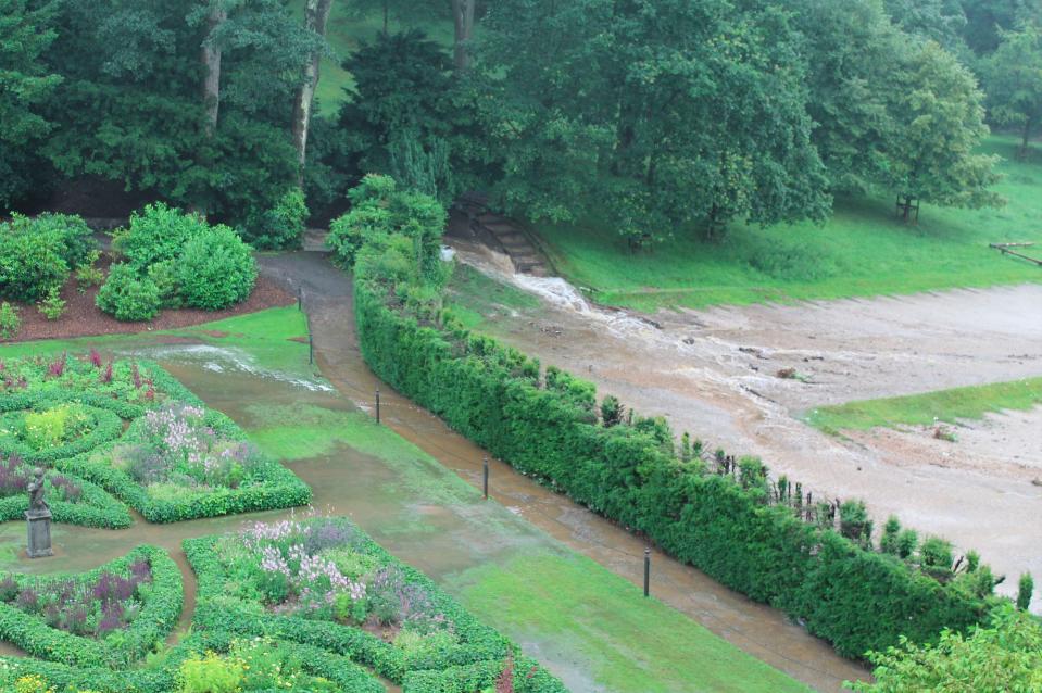
At Lyme Park in Cheshire, which was hit by a major flood in 2019, the team is undertaking tree planting on moorland to slow the flow of water and reduce flooding risks.
At Mount Stewart, Northern Ireland, where rising sea levels in Strangford Lough have contributed to coastal erosion, the carpark has been relocated and a shelter-belt from incoming sea water created.
And at Malham Tarn, in the Yorkshire Dales, an otherwise sound 18th century barn collapsed due to soil shrinkage, but teams can now intervene with moves such as tree planting and using certain plants to manage the water table.
A 16th century listed farmhouse in Wales, Dyffryn Mymbyr in Snowdonia has been protected against the impact of increased driving heavy rainfall by installing “slate hanging” on the exposed end of the building.
The map plots the impacts of extreme heat and humidity, landslides, coastal erosion, shrinking and shifting ground due to wet and dry conditions known as “soil heave”, and high winds, in 2020 and 2060.
It uses data from a number of sources and plots them in 5km hexagonal grids across England, Wales and Northern Ireland.
The National Trust is also sharing available data on flooding with staff on properties prone to flooding and action that can be taken, but the information is too localised to be included on the map.
Read More
Government faces growing calls to give NHS ‘ heroes’ bigger pay rise
Scottish voters ‘could face an independence referendum in late 2021’
The coast is dear as demand for beach destinations pushes prices up
