
 Yahoo Movies
 The records are in: Here’s how much rain fell Sunday from Sacramento’s ‘bomb cyclone’ storm
It’s official: More rain fell Sunday than any other day in Sacramento’s recorded history, the National Weather Service confirmed on a waterlogged Monday morning.
The bomb cyclone and atmospheric river storm striking Northern California exceeded forecast expectations, bombarding the capital with more than 5 inches in 24 hours.
The official mark from 1 a.m. Sunday to 1 a.m. Monday at the weather service’s city station near Sacramento State was 5.44 inches, gushing past the previous record of 5.28 inches, which had stood since April 20, 1880.
In the 141-year interim, no other day even breached 4 inches.
Marking an exceptionally severe and early start to the rainy season, Sunday obliterated the previous daily record, 1.21 inches, set Oct. 24, 2010.
Sunday also smashed the record for any October day, previously 3.63 inches on Oct. 13, 1962. In fact, it rained more on Sunday than it did during the entirety of any October on record, except for 1962.
The region jolted between climate extremes in dramatic fashion. A record-setting dry spell preceded Sunday’s deluge: Downtown Sacramento had gone 212 consecutive days, from late March to mid-October without measurable rainfall.
The weather service’s measuring station at Sacramento Executive Airport recorded 5.41 inches, smashing the previous record of 3.77 inches, also set Oct. 13, 1962.
With the mammoth downpour, Sacramento in a single day recorded more than 80% as much rainfall as it received in all of the 2020-21 water year. The city got just 6.61 inches between October 2020 and September 2021.
Records were also broken for Blue Canyon, Northern California’s typically wettest location, with 10.40 inches. That broke the all-time, one-day record set there on Dec. 22, 1964. The previous one-day for Oct. 24 was 6.34 inches set in 2010.
Daily rainfall records were also set at Oroville Airport (4.57 inches), Redding Airport (2.99) and Sacramento International Airport (4.13).
Farther north on Sunday, several locations in the Sacramento Valley and Sierra Nevada foothills eclipsed 8 inches, including near Grass Valley, Chico and Paradise.
Over the course of just 24 hrs, Sac Exec Ap received 81.9% of the total precip from the entire 2020 - 2021 water year! Here is a look at some comparisons. Rain is still falling, so stay tuned for updates on the storm total precip amounts from this #AtmosphericRiver #CAwx #CArain pic.twitter.com/HpjMEfeWyb
— NWS Sacramento (@NWSSacramento) October 25, 2021
Downtown #Sacramento set an all-time 24 hr rainfall total. 5.44 inches were recorded, breaking the old record of 5.28 inches set back in 1880. #CAwx #CArain #atmosphericriver pic.twitter.com/dI3JoLILeb
— NWS Sacramento (@NWSSacramento) October 25, 2021
At around 8 p.m., as Sacramento neared 5 inches inches, weather fanatics kept a close eye on the readouts from SMTC1, the identifier for the “downtown” automated gauge.
“It’s going to be close,” NWS meteorologist Robert Baruffaldi said a few hours before the mark was toppled. “We got three more hours, it’s certainly very doable to beat that record. ... We’re getting a quarter of our rainfall (in our water year) in one day.”
The 30-year average for the water year, which started Oct. 1, is calculated to an average of 19.20 inches.
“When you think of it in those terms, it’s pretty nuts,” he said.
24-hour rainfall totals through 1 a.m.
Here is how much rain has fallen in the 24-hour period from 1 a.m. Sunday to 1 a.m. Monday, according to the National Weather Service:
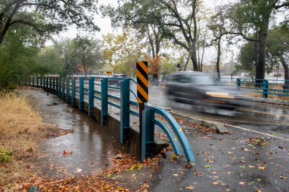
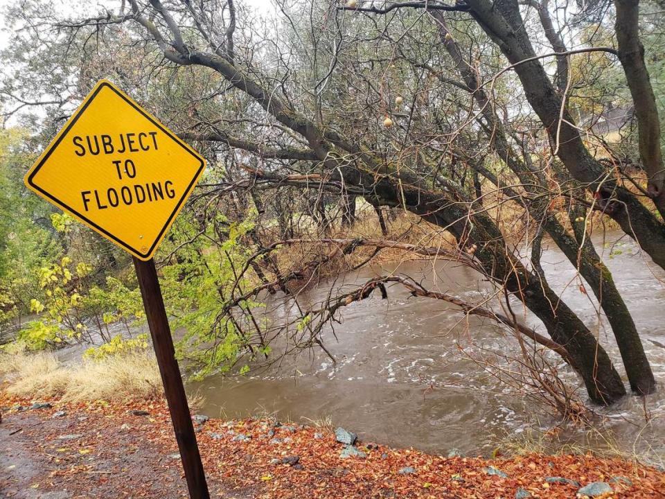
Rain, flooding, evacuations, road closures: Sunday was a record-setting day in Sacramento region
SACRAMENTO COUNTY
Sacramento: 5.44 inches
Sacramento Executive Airport: 5.41
Sacramento International: 4.13
Midtown: 5.54
Rosemont: 6.92
Elder Creek at Stockton Blvd.: 6.23
Elk Grove: 6.73
Wilton: 4.97
Herald: 4.85
Sloughhouse: 5.66
Mather Airport: 4.59
Fair Oaks: 5.36
Folsom Lake: 4.10
Orangevale: 6.50
Foothill Farms: 6.12
Arcade Creek at Watt Ave.: 5.16
Chicken Ranch Slough at Arden Way: 5.24
Hansen Ranch: 5.55
Rio Linda: 4.69
PLACER COUNTY
Blue Canyon: 10.40
Roseville: 4.69
Rocklin: 5.63
Lincoln: 4.89
Lincoln Airport: 3.13
Newcastle: 5.16
Auburn: 6.63
Auburn Airport: 6.74
Colfax: 6.38
Truckee River at Tahoe City: 4.72
Tahoe-Truckee Airport: 1.89
EL DORADO COUNTY
Cameron Park: 7.57
El Dorado Hills: 7.30
Plymouth: 5.71
Placerville Airport: 5.58
Camino: 5.33
Pollock Pines: 7.40
Strawberry: 4.27
Echo Peak: 6.30
South Lake Tahoe: 4.88
YOLO COUNTY
Davis: 3.30
Woodland: 3.86
Winters: 2.38
Bryte Bend: 4.71
Clarksburg: 5.97
Cache Creek at Brooks: 4.92
OTHER NOTABLE SITES
Grass Valley: 8.82
Nevada City: 7.15
Paradise: 8.22
Forbestown: 9.99
Redding Airport: 2.99
Oroville Airport: 4.57
Travis AFB: 4.48
Beale AFB: 4.80
24-hour totals through 4 p.m. Sunday
Here’s how those numbers stacked up before the evening portion of the storm in the period between 4 p.m. Saturday and 4 p.m. Sunday:
SACRAMENTO COUNTY
Sacramento Executive Airport: 3.44 inches
Official Sacramento gauge, Sacramento State: 3.33
Midtown Sacramento: 3.52
Chicken Ranch Slough at Arden Way: 3.15
Granite Park, Rosemont: 4.32
Elk Grove: 3.46
Orangevale: 4.10
Fair Oaks: 3.34
Foothill Farms: 3.84
Rio Linda: 2.79
Hansen Ranch: 3.20
YOLO COUNTY
Clarksburg: 4.13 inches
Davis: 2.23
Woodland: 2.44
Winters: 3.89
Cache Creek, Brooks: 3.84
EL DORADO COUNTY
El Dorado Hills: 8.48 inches
Placerville: 1.89
Cameron Park: 3.42
Diamond Springs: 1.13
Camino: 2.98
Pollock Pines: 4.39
Strawberry: 2.77
South Lake Tahoe: 2.87
PLACER COUNTY
Rocklin: 3.55 inches
Roseville: 2.72
Loomis: 2.48
Lincoln: 2.95
Doty Ravine: 6.38
Auburn: 3.02
Auburn Airport: 3.97
Colfax: 3.80
Alta: 3.51
Blue Canyon: 6.69
Palisades at Tahoe: 5.68
Tahoe Vista: 1.85
OTHER NOTABLE SITES
Nevada City: 4.10 inches
Grass Valley: 6.25
Chico: 7.03
Paradise: 5.68
Oroville Airport: 7.34
Brush Creek, above Lake Oroville: 8.54
New Bullards Bar Dam: 5.97
Hidden Valley Lake, Lake County: 7.96
Healdsburg, Sonoma County: 6.63
Santa Rosa: 8.85
San Rafael, Marin County: 7.28
12-hour totals through noon
Here were the precipitation totals for midnight to noon on Sunday:
Sacramento Executive Airport: 1.69 inches
Midtown Sacramento: 2.06
Sacramento station (at Sacramento State): 1.82
Granite Park, Rosemont: 2.51
Strong Ranch Slough at Hurley, Arden Arcade: 1.58
Elder Creek at Stockton Blvd., south Sacramento: 1.66
Rancho Cordova: 1.54
Arcade Creek at Watt Avenue: 1.58
Fair Oaks: 1.78
Orangevale: 2.09
Foothill Farms: 2.11
Arcade Creek at Greenback: 1.89
El Dorado Hills: 4.75
Pollock Pines: 2.20
Placerville: 1.93
Cameron Park: 1.82
Loomis: 1.67
Hidden Falls Regional Park, west of Auburn: 3.78
Auburn: 1.59
Elk Grove: 1.71
Hood: 2.11
Fairfield: 3.72
Davis: 0.97
Woodland: 1.54
West Sacramento: 1.37
Rio Linda: 1.61
Lincoln: 1.75
Roseville: 1.46
Grass Valley: 4.19
Nevada City: 6.94
Paradise: 4.87
Forbestown: 4.89
Beale Air Force Base: 2.18
Travis Air Force Base: 2.11
