
 Yahoo Movies
 Messy system means difficult navigation across parts of B.C. Saturday
The weekend will get off to a rainy, snowy and windy start for a good portion of southern B.C. Blustery winds and heavy, alpine snow will make travel quite treacherous in some regions, while rainfall on the South Coast could bring pooling on roads and just make for a dreary day.
SEE ALSO: B.C. faces the driest conditions in North America despite La Niña
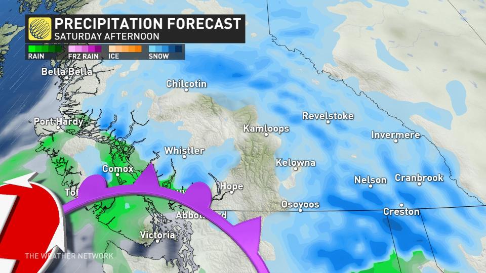
A strong frontal system is bringing snow, at times heavy, to the mountain passes and Interior, and rain to Vancouver Island. Wind, rainfall and snowfall warnings are in effect.
The system will continue to bring a mix of rain and snow to Vancouver Island. Regarding rainfall, an additional 30 mm is expected through Saturday evening. Rainfall will be the dominant precipitation phase across communities closer to sea level and will be heaviest in the morning.
Come afternoon, steady rainfall will persist until the evening once the system tracks out of the region.
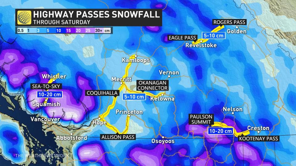
Snow will continue through the afternoon, tapering off to flurries in the evening as the system weakens. The storm is anticipated to produce a further 10-20 cm for some regions.
Watch for dangerous road conditions, especially along some major highways where a decent blanket of snow is expected by the time the skies clear out.
Blustery conditions will start winding down for the coast early Saturday morning. Until then, Victoria could see strong gusts upwards to 90 km/h, and Vancouver could see gusts up to 50 km/h.
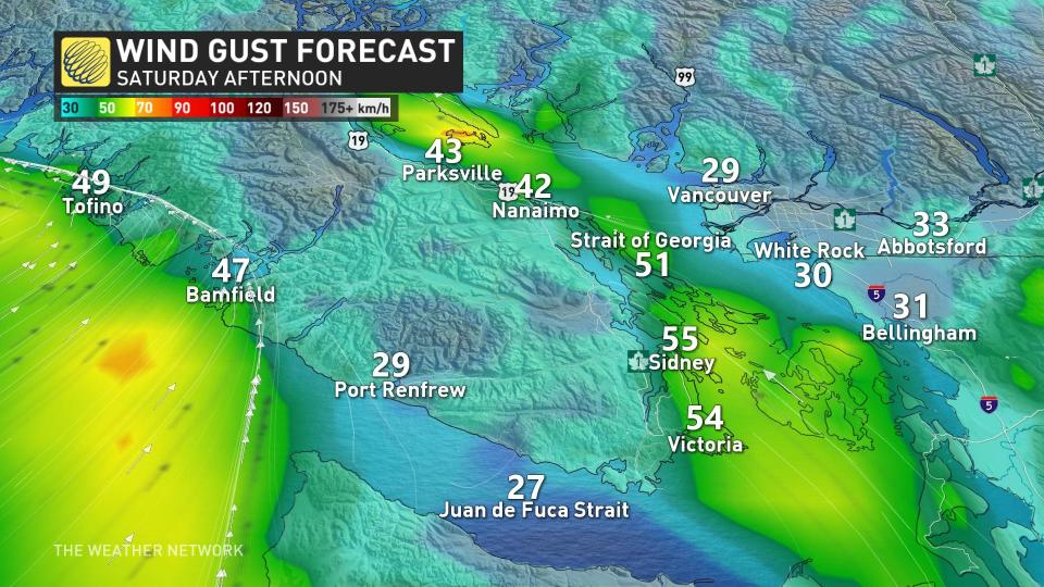
In additional to the very strong winds, the event will also coincide with local high tides at 10 a.m. local time on Saturday. The combined force of the two could create a high water level situation along beaches, affecting coastal walkways and debris washing further up the shoreline. Extra caution is recommended during this time.
WATCH: What makes the Coquihalla dangerous in the winter?
Check back for the latest weather updates across B.C.

