
 Yahoo Movies
 Latest earthquake hits a different part of the Columbia area
Another earthquake hit the Midlands Tuesday morning, but the latest seismic activity was in a different part of the Columbia area than where most of the previous swarm of quakes have occurred.
A 1.6 magnitude earthquake was confirmed in the Boykin area at 1:59 a.m., the South Carolina Emergency Management Division said. While still in Kershaw County, it’s about 21 miles east of Elgin, and 17 miles from Lugoff, where most of the recent earthquakes have been reported.
Tuesday’s earthquake happened about 4 miles beneath the surface, according to the U.S. Geological Survey.
This was the first seismic activity in South Carolina since a 1.8 magnitude earthquake was confirmed on Aug. 3.
There have been 37 confirmed earthquakes in Kershaw County in the past 45 days, according to the South Carolina Department of Natural Resources.
On June 29, two earthquakes — one a 3.5 magnitude and the other 3.6 — were included in that flurry of tremors and aftershocks. Those were the two largest quakes to hit South Carolina in nearly a decade. A 4.1-magnitude quake struck McCormick County in 2014.
Anyone who felt Tuesday’s earthquake can report it to the USGS.
The most recent earthquake means at least 66 have been detected in the Palmetto State since the start of 2022, according to South Carolina DNR. All but five of the quakes have been in the Midlands.
In all, 68 earthquakes have hit the Columbia area since a 3.3 magnitude quake was recorded Dec. 27, 2021, according to the DNR.
No major damage or injuries have been reported from any of the recent quakes.
Earthquakes that register 2.5 magnitude or less often go unnoticed and are usually only recorded by a seismograph, according to Michigan Technological University. Any quake less than 5.5 magnitude is not likely to cause significant damage, the school said.
It is typical for South Carolina to have between six and 10 earthquakes a year, the S.C. Geological Survey previously reported. There have been 93 earthquakes in South Carolina since Jan. 18, 2021, according to DNR.
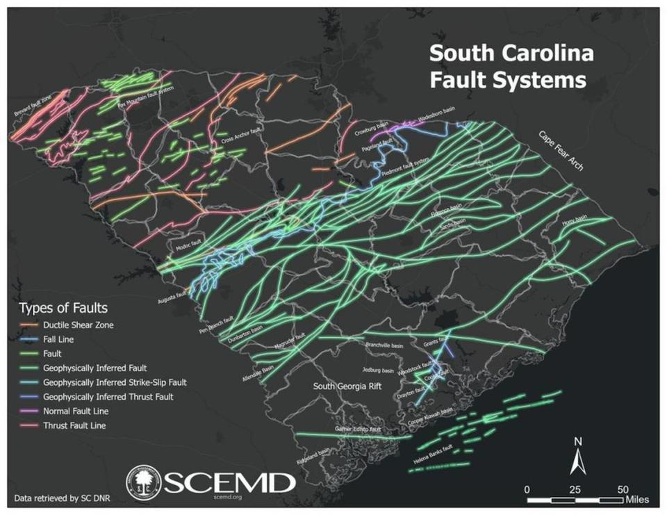
During a recent town hall to address the earthquakes, state geologist Scott Howard said as many as 200 smaller tremors might have gone unnoticed and unrecorded, “so there’s not enough information about their location,” he said. Recorded quakes have occurred in a northeast-oriented cluster near Elgin, Howard said, “which goes against the grain of structures known here in the Piedmont.”
Why the increase in earthquakes?
An explanation for the recent outburst has eluded scientists.
Some experts have theorized there’s a link between the Wateree River and the earthquakes northeast of Columbia. They said the combination of the single moderate earthquake in December and high water levels in the Wateree River during parts of this year have contributed to the earthquakes.
Other possible causes that have been discussed include digging and blasting at mines, water seeping through the ground from lakes or other changes in weight or pressure underground, The State previously reported. But no one has settled on the single cause for the Midlands’ shaking.
The South Carolina Department of Health and Environmental Control said that mining activity is not likely to be the cause of recent earthquakes, as mines in the Elgin area are shallow.
Elgin, located about 20 miles northeast of Columbia and situated on a fault line, has been experiencing an unusual earthquake “swarm” for the past several months, leaving some residents feeling uneasy. The series of quakes might be the longest period of earthquake activity in the state’s history, officials said. But officials have said they don’t believe the spate of minor earthquakes is an indicator that a bigger quake could be on the way.
“Though the frequency of these minor earthquakes may alarm some, we do not expect a significantly damaging earthquake in South Carolina at this time, even though we know our state had them decades ago,” South Carolina EMD Director Kim Stenson said in a news release. “Now is the time to review your insurance policies for earthquake coverage, secure any items in your home that may become hazards during a tremor, and remember to Drop, Cover, and Hold on until the shaking passes. These are the precautions South Carolinians can take to properly prepare for earthquakes.”
The strongest earthquake ever recorded in South Carolina — and on the East Coast of the U.S. — was a devastating 7.3 in Charleston in 1886.
That quake killed 60 people and was felt over 2.5 million square miles, from Cuba to New York and Bermuda to the Mississippi River, according to the Emergency Management Division.
Reported earthquakes in SC in 2021-22
Date/Location | Magnitude | Depth (km) |
Jan. 18/Dalzell | 2.1 | 6.9 |
Feb. 13/Summerville | 2.1 | 5.1 |
May 12/Heath Springs | 1.8 | 9.99 |
May 31/Summit | 2.6 | 1.7 |
May 31/Summit | 2.0 | 5.1 |
July 16/Ladson | 2.0 | 4.0 |
July 22/Ladson | 1.3 | 3.5 |
July 22/Ladson | 1.95 | 3.97 |
Aug. 21/Centerville | 1.75 | 1.97 |
Aug. 21/Centerville | 1.71 | 3.37 |
Sept. 27/Summerville | 2.8 | 6.0 |
Sept. 27/Summerville | 2.0 | 5.8 |
Sept. 27/Centerville | 3.3 | 6.8 |
Oct. 25/Jenkinsville | 2.2 | 3.8 |
Oct. 26/Jenkinsville | 1.8 | 0.0 |
Oct. 28/Jenkinsville | 1.8 | 1.8 |
Oct. 28/Jenkinsville | 1.7 | 0.0 |
Oct. 28/Jenkinsville | 2.1 | 4.2 |
Oct. 31/Jenkinsville | 2.3 | 0.1 |
Nov. 1/Jenkinsville | 2.0 | 5.1 |
Nov. 9/Centerville | 1.5 | 3.8 |
Nov. 16/Arial | 2.2 | 5.4 |
Dec. 20/Ladson | 1.1 | 2.8 |
Dec. 27/Lugoff | 3.3 | 3.2 |
Dec. 27/Lugoff | 2.5 | 2.4 |
Dec. 27/Elgin | 2.1 | 0.7 |
Dec. 27/Lugoff | 1.7 | 4.9 |
Dec. 29/Elgin | 2.3 | 1.6 |
Dec. 30/Elgin | 2.5 | 2.5 |
Dec. 30/Elgin | 2.4 | 3.8 |
Jan. 3/Lugoff | 2.5 | 2.7 |
Jan. 5/Lugoff | 2.6 | 0.5 |
Jan. 5/Lugoff | 1.5 | 7.0 |
Jan. 9/Ladson | 1.4 | 2.9 |
Jan. 11/Elgin | 1.7 | 5.4 |
Jan. 11/Lugoff | 2.0 | 3.2 |
Jan. 11/Elgin | 1.3 | 5.0 |
Jan. 15/Elgin | 1.8 | 3.5 |
Jan. 19/Elgin | 1.9 | 5.0 |
Jan. 21/Elgin | 1.9 | 4.8 |
Jan. 27/Lugoff | 2.1 | 1.0 |
Feb. 2/Elgin | 1.5 | 3.9 |
March 4/Elgin | 1.8 | 2.8 |
March 9/Elgin | 2.2 | 3.6 |
March 11/Camden | 2.1 | 1.2 |
March 27/Lugoff | 2.1 | 1.9 |
March 28/Centerville | 0.9 | 2.9 |
April 7/Elgin | 2.0 | 2.9 |
April 8/Centerville | 1.6 | 3.6 |
April 22/Ladson | 1.1 | 3.5 |
April 22/Taylors | 2.2 | 2.3 |
May 9/Elgin | 3.3 | 3.1 |
May 9/Elgin | 1.6 | 2.9 |
May 9/Elgin | 1.78 | 4.1 |
May 9/Elgin | 2.1 | 3.7 |
May 9/Elgin | 2.9 | 5.6 |
May 10/Elgin | 2.3 | 3.9 |
May 10/Elgin | 2.8 | 6.2 |
May 19/Elgin | 1.8 | 2.5 |
May 21/Elgin | 1.9 | 5.6 |
June 26/Elgin | 1.88 | 4.09 |
June 29/Elgin | 3.5 | 2.64 |
June 29/Elgin | 1.88 | 2.92 |
June 29/Elgin | 3.6 | 2.95 |
June 29/Elgin | 1.79 | 2.07 |
June 29/Elgin | 1.51 | 3.72 |
June 29/Elgin | 1.46 | 1.93 |
June 29/Elgin | 2.06 | 2.22 |
June 30/Elgin | 2.32 | 3.09 |
June 30/Elgin | 1.44 | 2.8 |
June 30/Elgin | 2.03 | 3.11 |
June 30/Elgin | 2.15 | 2.56 |
June 30/Elgin | 2.06 | 1.92 |
June 30/Elgin | 1.49 | 2.46 |
July 1/Elgin | 1.55 | 3.37 |
July 1/Elgin | 2.11 | 3.83 |
July 1/Elgin | 1.26 | 3.3 |
July 1/Elgin | 1.68 | 4.02 |
July 2/Elgin | 2.09 | 1.65 |
July 3/Elgin | 1.9 | 2.1 |
July 3/Lugoff | 1.6 | 3.2 |
July 3/Elgin | 1.4 | 1.96 |
July 3/Elgin | 1.1 | 5.0 |
July 7/Elgin | 2.1 | 4.0 |
July 8/Elgin | 1.6 | 2.5 |
July 8/Elgin | 1.4 | 3.8 |
July 14/Elgin | 1.3 | 2.5 |
July 15/Elgin | 1.6 | 3.3 |
July 18/Elgin | 1.2 | 3.2 |
July 19/Elgin | 2.2 | 1.8 |
July 19/Elgin | 2.1 | 3.2 |
July 24/Lugoff | 2.3 | 2.4 |
July 25/Lugoff | 2.1 | 2.2 |
July 30/Elgin | 1.8 | 3.6 |
July 31/Elgin | 1.7 | 1.6 |
Aug. 3/Elgin | 1.8 | 3.0 |
Aug. 9/Boykin | 1.6 | 6.9 |
