
 Yahoo Movies
 Schools in Florida Keys close as the island chain braces for Ian’s winds, storm surge
Monroe County public schools will be closed on Tuesday and government offices throughout the island chain will be shuttered as wind gusts topping 73 mph from Hurricane Ian are expected to hit the Keys by Tuesday morning, emergency managers said Monday.
Schools may also be closed on Wednesday although a final decision will be made Tuesday, county officials said at a Monday afternoon press conference.
Monroe County is not ordering an evacuation of the Keys ahead of the storm, but emergency management officials are urging those living in mobile homes, RVs and boats in Key West and the Lower Keys to seek shelter with friends and family elsewhere.
Hurricane Ian is expected to pass west of the Florida Keys late Tuesday, but the storm’s impact will be felt in the Lower Keys by Tuesday morning. The Lower Keys are under a tropical storm warning and National Weather Service Key West expects Key West, the Lower Keys and maybe even the Middle Keys city of Marathon to be hit with tropical storm force wind gusts between 58 and 73 mph.
Schools, offices to close
Several city offices and services will be closed in Monroe County on Tuesday and Wednesday. Key West offices will reopen on Thursday. Key Colony Beach and Islamorada offices will be closed on Tuesday; officials will decide by Tuesday whether they will be closed on Wednesday.
The city of Marathon offices will remain open, but that may change, a city official said Monday afternoon.
The Monroe County Sheriff’s Office will be open on Tuesday and is monitoring conditions to decide on staffing changes. Jails will remain open, and there are no plans to evacuate the north end jail as previously done during storms.
Concern over vulnerable populations
On Monday, Monroe County Commissioner Jim Scholl said he has been receiving calls from concerned residents about liveaboards, people who live on sailboats, houseboats or other vessels.
Some liveaboards might not have family to whom they can turn, Scholl said. And as tourists haven’t left the area, hotels might be booked or might be too pricey.
Greg Barroso, a Key West official, said he, too, was getting calls about shelters for liveaboards and other vulnerable populations.
During the Monday afternoon meeting, the county said it decided not to open general populations shelter. But county emergency management officials said they will take the conversation offline about whether to open a shelter for liveaboards and other vulnerable populations. A decision most likely will come on Tuesday.
How Ian can affect the Keys
In addition to the threat of high winds, the entire archipelago, all the way through the North Key Largo gated enclave of Ocean Reef, could see isolated tornadoes, said Jonathan Rizzo, warning coordination meteorologist for National Weather Service Key West.
“The fact that we have tropical storm warnings and a watch for the Middle Keys is a testament to the size of the storm,” Rizzo said. “And therefore, its effects will be far reaching.”
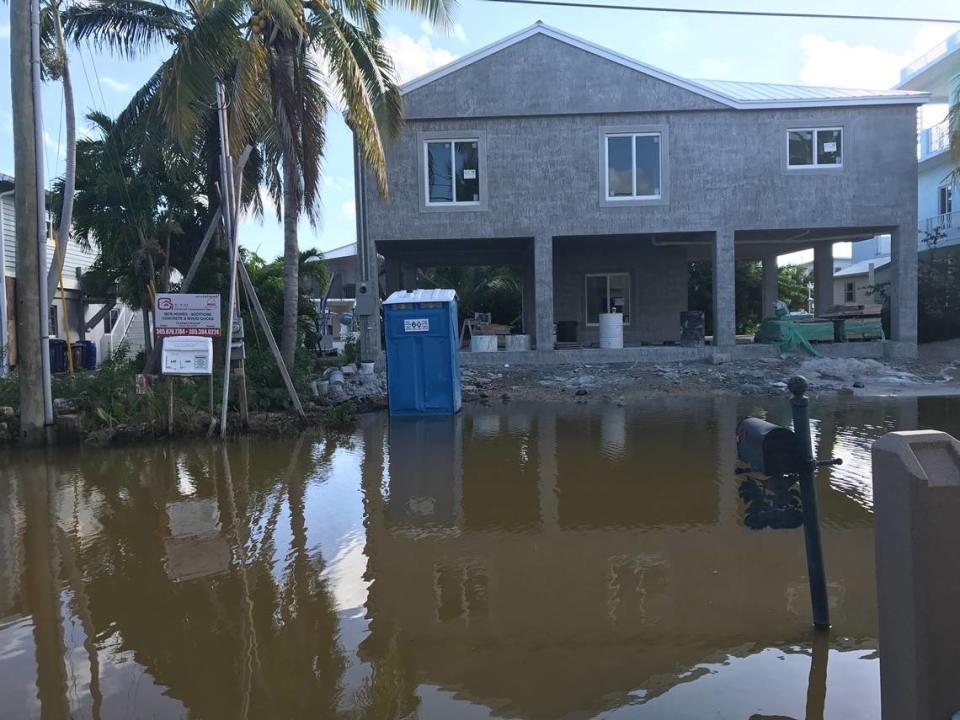
More important, the storm is expected to bring heavy flooding that will exacerbate already higher-than-normal water surrounding the island chain that is due to king tides this time of year.
A king tide is one of the highest tides of the year and is set to peak this week. Tides run higher than normal for days after the peak of a king tide. During king tide season, streets on some residential areas of the Keys, including Florida Bay neighborhoods in Key Largo, are impassable for most residents’ vehicles.
READ MORE: Hurricane Ian is coming when king tides will be in Florida. What to know about high tides
“We’re nearly a foot above what we should be already,” Rizzo said during Monday morning’s briefing.
The bay, ocean and Gulf of Mexico waters surrounding the Keys could be 3 feet higher after Ian passes than normal high tide, Rizzo said.
Jamie Rhome, acting director of the National Hurricane Center, noted that the king tides, slated for Tuesday and Wednesday, Sept. 27-28, are already accounted for in the hurricane center’s predictions.
”That has the potential to be a pretty impactful event down there because it could cut off roads,” he said.
Key West and Lower Keys residents should expect street flooding days after the storm passes.
And, because of the geography of Florida Bay, surge from the storm is expected to build up to the point where some Upper Keys residential streets, especially in Key Largo neighborhoods like Stillwright Point and Twin Lakes that are prone to flooding, will be impassable for days, Rizzo said, especially with no fronts expected to blow the water out of the bay.
This means that many residents will be unable to leave their neighborhoods to get necessities like groceries.
“They may not have access to the highway for some time,” Rizzo said.

