
 Yahoo Movies
 Driving down the Overseas Highway in the Florida Keys? What to know about your trip
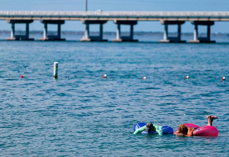
You’re on the Overseas Highway, the only stretch of pavement connecting the 120-mile island chain. Destination: Key West, where the mile marker zero sign signals the end of the road.
This drive is an adventure with breathtaking water views as you move from island to island. And if you’re lucky enough to hit the highway at sunrise or sunset, you’ll behold even more beauty.
But this road trip comes with risks.
Besides the water, common sights include sports cars whipping over bridges. Slowpoke rental cars. Huge 18-wheelers, and an assortment of RVs, motorcycles, construction vehicles and bicycles.
Then there are the reckless or distracted drivers who pass illegally, sometimes on the shoulder, or hit high speeds. People make last-minute turns. And a crash will bring everything to a halt, sometimes for hours.
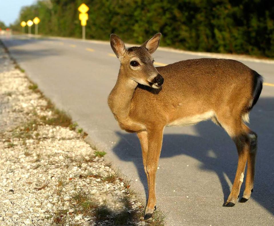
Remember, for many communities, the Overseas Highway is Main Street, with shopping centers and pedestrian crossings. On one section, endangered Key deer have inspired a slow-down to 35 mph at night.
There’s lots to know about driving on the Keys’ highway. Here’s a user guide on the famous road to help you stay safe and enjoy the ride.

What is the Overseas Highway?
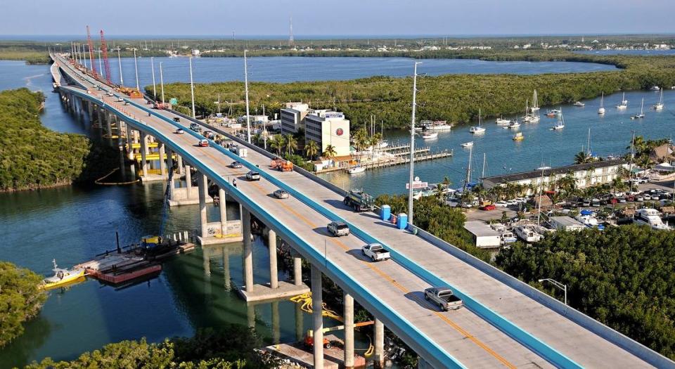
The Overseas Highway encompasses 113 miles of U.S. 1 and is the only road to span the entire chain. It runs through the Keys over the Atlantic Ocean, Florida Bay and the Gulf of Mexico.
It all begins and ends in Key West, where the mile marker zero signs are at Whitehead and Fleming streets.
The entire highway is measured by green mile marker signs on the side of the road. Locals refer to mile markers when giving addresses and they’re commonly used as directions for businesses and attractions.
When it comes to determining the length of the Overseas Highway — that is, exactly where it begins and ends — and the number of bridges, opinions vary. But the Florida Department of Transportation says the scenic highway is 113 miles long, which is the distance between the Monroe/Miami-Dade line and downtown Key West, with 43 bridges along the way.
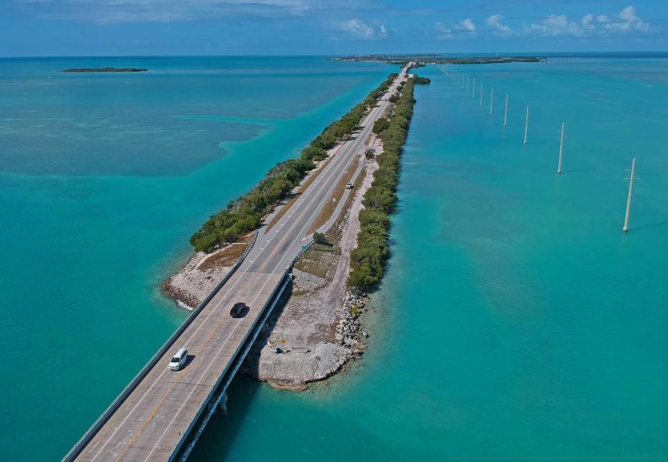
The longest span is the Seven Mile Bridge, which is actually 6.79 miles long. The second longest is the Long Key Bridge, at 2.3 miles.
Are we there yet? How long is it to Key West?
You’ll want to plan ahead. Always allow more time than Google tells you.
Heavy traffic congestion in the Upper Keys, especially on the weekends, can bring things to a crawl. Passing is allowed only in certain spots and isn’t always an easy escape behind a slowpoke. Most of the highway is two lanes.
Driving times vary, but here are some estimates:
▪ It’s about a four-hour trip from Miami to Key West on a good day, and under three hours from Florida City to Key West without delays.
▪ A trip from Key Largo to Key West can take 2 1/2 hours, depending on conditions.
▪ Getting from Miami to Key Largo takes about two hours.

Is there an app for this?
Two free apps can help you navigate the Overseas Highway. One is for traffic and the other is a guide to the Keys.
▪ The Monroe County Sheriff’s Office has an app that is a must-have for people who must take the road regularly. The app has a “live calls and traffic info” tab that gives the location and times of crashes or other traffic disruptions, such as when a medical transport helicopter is landing on the highway.
You can also sign up for notifications, which will tell you when lanes are reopened.
The sheriff’s office also posts about crashes in real time on its Facebook and Twitter feeds, which you can access through the app.
▪ A travel app from the Monroe County Tourist Development Council features just about everything you want to know about exploring the islands. The app includes narrated driving tours — one for each direction of the highway — along with lists of hotels, restaurants, art galleries, watersports rentals and fishing guides.
Information is categorized by location: Key West, the Lower Keys, Marathon, Islamorada and Key West. The app also has videos of the Keys, a map and weather forecasts.
Both apps are available through the Apple Store and Google Play.
Is it dangerous?
The Overseas Highway has some problems. First, most of the road is two lanes and passing is limited. The speed limit never goes higher than 55. And the drive may be stunning, but it’s also filled with distractions.
Sgt. Greg Korzen, the traffic unit supervisor for the Monroe County Sheriff’s Office, reminds travelers to keep their eyes on the road to avoid problems.
“Pay attention,” Korzen says. “There are way too many distractions.”
This isn’t Interstate 75 where you’re on a highway with nothing much to see, he said.
“There is so much to see on the highway, whether it’s the big lobster [statue in the Upper Keys named Betsy] or bridges or the clear ocean, the blue and green water,” Korzen said. “People are looking around and some are even taking pictures. Really try to avoid any kind of distractions. Concentrate on driving. If there are points of interest, pull over.”
Patience is also needed for the drive, Korzen said.
Again, it’s a highway where you can’t legally go over 55 mph, and some travelers don’t realize the stamina the trip can take down to Key West. Expect a long drive. Expect to share the highway with people towing boats and tourists going under the speed limit.
“They anticipate it’s a two-hour drive and it turns into a four-hour drive,” Korzen said of some travelers.

Are there any tolls?
There are no tolls on U.S. 1 — although the idea has been floated by Keys officials for years.
But there is a toll on Card Sound Road, which is an alternative to the 18 Mile Stretch to get in and out of the Keys.
The Card Sound toll is $1.60 for cars, pickups and motorcycles. It’s $3.15 for vehicles with three axles. For each additional axle, $1.05 is tacked on.
The toll is collected electronically through Toll-By-Plate, SunPass, or other highway passes like E-Pass or EZ-Pass. Cash is not accepted.
The money goes to road maintenance and future repair and replacement of the five bridges along Card Sound Road, according to county spokeswoman Kristen Livengood.

How fast can I go?
The speed limits change along the highway, and by law you’ll only be able to go up to 55 mph in certain places. Until you hit downtown Key West, you’re looking at moving at 50 mph for most of the road.
Expect to go a bit slower when you start to see clusters of businesses and homes because the Overseas Highway doubles as Main Street for the many small communities.
Speed limits drop to 45 mph in residential spots such as Cudjoe Key and Big Coppitt in the Lower Keys.
A piece of the highway through the Middle Keys city of Marathon has a 35 mph limit.
There is also a 35 mph limit zone at night on Big Pine Key, from mile marker 29.5 to 33. It’s all about protecting the endangered Key deer, the dog-sized animals often drawn to the busy highway. During the day, the limit on Big Pine is 45 mph.
In Key West, speed limits are between 25 mph from about mile marker 0 to 1 and rise to 35 mph from about mile marker 1.7 to 4.5.
Do I have to take the 18 Mile Stretch?
You can choose between the 18 Mile Stretch and Card Sound Road.
Many locals prefer Card Sound, even though there’s a toll. But be aware that it is a rural, two-lane highway. The Stretch, meanwhile, has concrete median barriers between the northbound and southbound lanes to protect against head-on crashes. The barriers are painted light blue, and the Stretch has better passing options with two lanes in each direction.
What if my car breaks down? Are there call boxes?
There are no call boxes or emergency call stations on the Overseas Highway. You’ll need to make emergency calls on a cellphone.
Sgt. Korzen, of the Monroe County Sheriff’s Office, offered advice.
Every situation can be different but when asked for general recommendations on what to do if you have a flat tire on the Seven Mile Bridge, he recommends:
▪ Calling 911 and waiting for a deputy to arrive.
▪ Moving as close to the edge as possible.
▪ Putting on your emergency lights.
▪ Staying in the car.
“Driving on a flat tire, you don’t have full control of the vehicle,” he said. “You may not be able to control your vehicle from swerving.”
For minor crashes, people should try to get out of the travel lanes, Korzen said.
“State law requires you, for fender-benders, to move out of the traffic lane because traffic will back up quick and more accidents could happen,” Korzen said. “You’re safer on the shoulder.”
