
 Yahoo Movies
 UK weather: Torrential rain hits London after huge floods spark major incident in Scotland
Torrential rain will hit London today after huge floods sparked a major incident in Scotland.
The capital is set to see three days of heavy rain starting this morning.
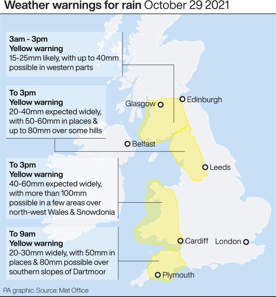
Southwest England and Wales will also be hit with a yellow weather warning for rain today until tomorrow afternoon.
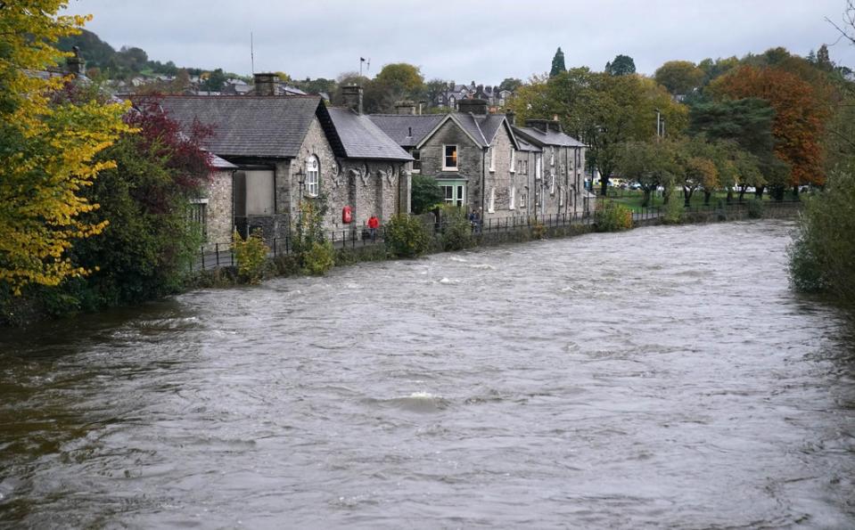
Weather warnings of heavy rain are in force across southern Scotland and northern England, including an amber alert for Cumbria which warns of “danger to life from fast flowing or deep floodwater”.
These areas could see a month’s worth of rainfall in one day, forecasters said.
Scotland has already been badly hit by the deluge, with two road bridges that spanned the River Annan in Dumfries and Galloway washed away on Thursday.
A cross-border rail line from Dumfries to Carlisle remains closed with trains unable to pass over a viaduct.
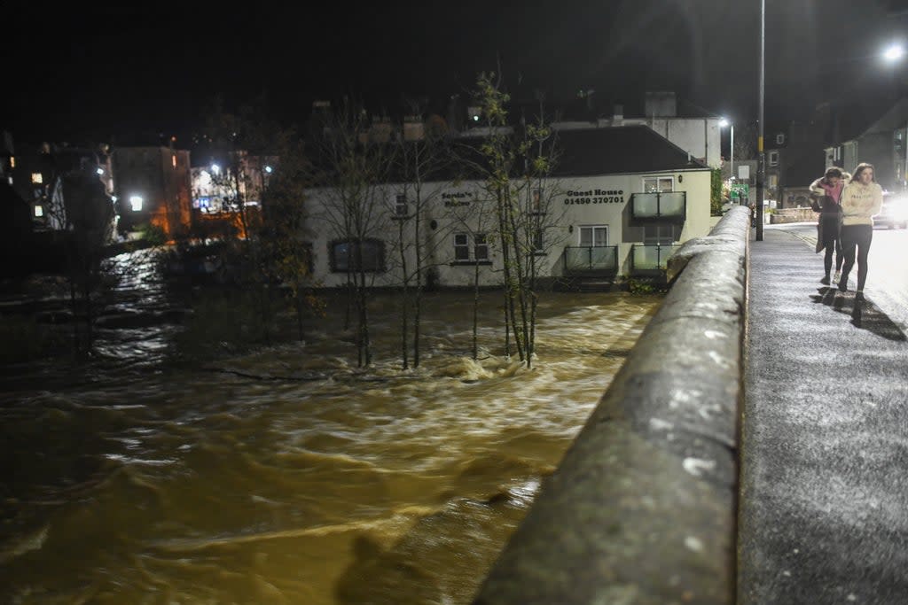
A major incident was declared in Hawick in the Scottish Borders with up to 500 properties feared to be at risk of flooding.
An evacuation of homes has been halted with residents advised they are safe to return and a rest centre closed.
The major incident was stood down after Scottish Environment Protection Agency (Sepa) indicated the River Teviot reached a peak of 2.9m at 7.30pm and is now expected to steadily recede.
Schools and a health centre in the town were closed earlier along with schools in Peebles which was also hit by flooding as the River Tweed burst its banks.
The Scottish Borders Council said: “The evacuation of residents has now ceased and members of the public are being advised that they are safe to return to their homes.”
Heavy rain and floods have hit travel across southern Scotland and northern England
Sepa has issued 20 flood warnings and five flood alerts mainly covering southern Scotland, while in England 16 flood alerts and nine flood warnings are in place in the North West.
A minor landslide has blocked the B725 road around six miles from Dumfries and as police warned of large areas of flooding on that road from Dumfries to Glencaple.
As well as the Dumfries to Carlisle line, other trains were disrupted by the weather, including the Edinburgh to Glasgow Central via Shotts, Edinburgh to Glasgow Queen Street via Falkirk High and Glasgow Queen Street to Alloa/Aberdeen/Inverness services.
An amber warning of heavy rain for Cumbria in north-west England was in force until 11.59pm on Thursday while a yellow warning of rain, which also includes Yorkshire and Humber, was in force from midnight until 3pm on Friday.
A yellow warning of rain for south-west England applies from 3pm on Thursday until 9am on Friday while one is already in force in Wales and lasts until 3pm on Friday.
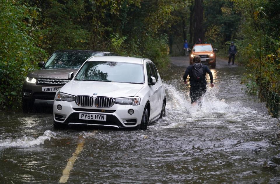
Cumbria Police warned some roads may be impassable, while at around 6am on Thursday South Lakes police tweeted the A591 Rydal to Grasmere road was not passable “due to the depth of flood waters in several locations” and urged people not to take unnecessary risks and only to travel if they really need to.
Scotland’s transport minister Graeme Dey said: “The conditions could potentially bring disruption to the trunk road and rail networks, so it’s important people plan their journeys before they set off.
“Motorists should make sure their routes are available, follow travel advice from Police Scotland and drive to the conditions.”
He added: “If you are planning to travel by rail, please check with your operator ahead of your journey.
“This is particularly important for cross-border travellers following the earlier disruption to services.”
Trick-or-treaters should keep umbrellas and puffy jackets close by as London is expected to be hit by heavy showers this Halloween weekend.
Temperatures in the capital are set to plummet to 10C, with chilly nights and the first frosts of the season predicted.
Nicola Maxey, a spokesperson for the Met Office, said: “It’s looking fairly dry today with some sunny spells. Overnight there will be heavy run coming in from the west side of the country. There is potential for heavy showers from rain pushing in from the continent.
“Rain will reach the south east and London by tomorrow morning and will stick around throughout the afternoon. It is set to be wet and windy throughout the weekend in London and into the start of next week. There will be heavier rain throughout the course of Sunday and we may issue a yellow warning across the south coast which could take in London.”
Average temperatures in the mid-teens are expected on Saturday, with the mercury reaching around 14C on Sunday before falling to as low as 10C as the week draws to a close.
The Met Office tweeted on Thursday evening 370mm of rain had been recorded at Honister Pass in Cumbria between 1am on Wednesday and 6pm on Thursday.
It reported 132mm of rain at Eskdalemuir in Dumfries and Galloway in the same period.
The Met Office has predicted persistent and heavy rain on Friday which could become drier by the afternoon with a risk still on heavy showers.
Read More
Flooding risk this weekend as capital to be battered by downpours
Glasgow hit with heavy rain and flooding ahead of COP26 summit

