
 Yahoo Movies
 California properties at risk of wildfire expected to see sixfold increase in 30 years
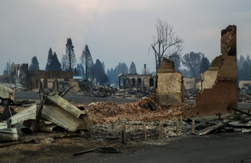
The number of California properties facing severe wildfire risk will grow sixfold over the next 30 years when considering only the impact of climate change, according to projections released Monday by a nonprofit research group.
Just over 100,000 properties in the state currently have a 1% or greater annual chance of being affected by wildfire. The number is expected to reach about 600,000 by 2052, according to the data from First Street Foundation.
The modeling, which marks the first effort to calculate the fire risk of each property in the United States, assumes that development will remain constant and takes into account only climate inputs, according to Jeremy Porter, the foundation’s chief research officer.
The research is undergoing peer review.
“When in 30 years, you have a six times increase in the most severe category, with 600,000 homes at that level, that is just unbelievable to think about when you see how quickly the impacts are changing from what are relatively small changes in heat,” said Matthew Eby, founder and executive director of the First Street Foundation. “And just the impact of heat on the fuels and humidity and drought cause these huge swings in the probability of these events that take place.”
Overall, more than half of all properties in the lower 48 states — nearly 80 million — are at some risk of being affected by wildfire, with about 1.9% of properties facing an annual risk of 1% or greater, according to First Street Foundation. That figure also is projected to rise.
“On average, the burn probability — the likelihood of the risk of wildfire — is about doubling over the next 30 years, and that’s across the country,” Porter said. “So on average, any property that has risk is likely to see that risk double. And then that also brings into account a lot of places that don’t have risk today are going to see risk moving into the future.”
The climate signal on fire appears to be much stronger than researchers saw when they modeled the increasing risk of flood several years ago, he added.
In California, more than 4.6 million properties — about 41% — have a .03% or greater chance of being involved in a wildfire this year. That figure is expected to grow in 30 years by 7.6% to include more than 5.5 million properties, according to First Street Foundation’s projections.
The California county with the most growth in that level of risk over the next 30 years is expected to be Sonoma, with a 41.6% increase, followed by Napa, Marin, Yolo and Santa Barbara, according to the projections. The 2017 fires in wine country, which burned through parts of Napa, Lake, Sonoma, Mendocino, Butte and Solano counties, were among the state’s most destructive, with some 8,400 buildings destroyed.
The analysis used the .03% threshold as a baseline for significant risk because it translates to a 1% chance of a property being affected by fire over 30 years, the average life of a mortgage. The nonprofit's goal is to ensure that people have the necessary information to understand the climate risk to a specific property when they buy or rent it, Eby said.
When it comes to the sheer number of properties facing a fire risk this year of at least .03%, Southern California counties occupied three of the top five spots in the U.S.: Riverside County ranked first, with 684,400, or 77.2% of its properties; Los Angeles was third, with 514,500, or 24.5%; and San Bernardino County was fifth, with 471,700, or 57.4%. But when it comes to counties with the highest proportion of properties with an annual fire risk of .03% or greater, none in California ranked in the top 20; the top-ranking counties were in New Mexico and Texas.
The researchers created the simulations using the Forest Service’s 2016 Landfire data set, which they updated with additional sources to account for more recent prescribed burns and disturbances, to assess the state of fuels, Eby said. They used a weather data set from the National Oceanic and Atmospheric Administration that provided a 10-year time series and updated that with information from the Intergovernmental Panel on Climate Change, he said.
Researchers used the information to run hundreds of millions of simulations to understand the fire probability of every 30-by-30-meter pixel across the country both this year and in 2052, he said.
The results differ from existing risk mapping from the federal government and the California Department of Forestry and Fire Protection because they project risk over time and take into account specific property-level information, down to construction materials, vent exposure and the amount of defensible space surrounding a home, which can be gleaned from tax assessor records and satellite images, Eby said.
Federal employees are prohibited from endorsing or not endorsing private businesses, the Forest Service said. But Greg Dillon, director of the Fire Modeling Institute at the agency’s Rocky Mountain Research Station, said the methodology appeared sound.
“I think the more we can get homeowners and communities thinking about their risks and what they can do to take action about them, the better,” he said.
Dillon led the modeling efforts used in the Forest Service’s Wildfire Risk to Communities mapping, which models fire risk at a community level. He said the agency does not drill down to the parcel level in its modeling because there are potential uncertainties and because it believes the community is an appropriate scale for action when it comes to mitigating risk.
“If one home in a neighborhood works to mitigate their wildfire risk, but their neighbors aren’t doing anything, then they're not effectively reducing their risk very much,” he said. “It takes community action.”
Forest Service researchers are working on determining the best way to incorporate climate change projections into wildfire risk modeling, but it’s a complex process, Dillon said.
“There are Forest Service researchers doing very similar work, and they’ve also found increases in fire risk over time,” he said. “But again, I think we’re still really trying to get the science right before we move forward on that.”
First Street Foundation’s data were surprising in terms of both the overall increase in wildfire risk and the places that are facing the most dramatic increase in risk, Eby and Porter said. For instance, for counties facing the greatest 30-year percentage increase of properties with at least a .03% risk of fire, Georgia occupied three of the top five spots. (The other two counties were in Oklahoma and Montana.) At the same time, Porter added, areas in the South tend to see a higher incidence of moderate and minor wildfire risk, while areas in the West have a higher incidence of properties at higher levels of risk.
“It’s not that it’s not growing in the West,” he said. “It’s just that it’s going to become a more prevalent problem across the U.S. It’s not really going to be just a Western issue moving forward.”
This story originally appeared in Los Angeles Times.

