
 Yahoo Movies
 The 10 best pub walks in the Cotswolds
These walks are spread over an area from Winchcombe, in the shadow of that walker’s dream, the limestone escarpment known as the Cotswold Edge, to the brooding flatlands of the RSPB Nature Reserve at Otmoor, north of Oxford. The pubs are all chosen for their individual charm, great food and friendly welcome after an adventurous yomp into the unknown. Seek them out this summer. For more inspiration in the area, see our guide to spending a weekend in the Cotswolds.
1. Belas Knap Long Barrow & Cleeve Common
8½ miles
Start/finish: The Lion Inn, Winchcombe (thelionwinchcombe.co.uk)
Explorer map OL45: OS Grid Reference SP024285
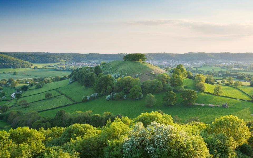
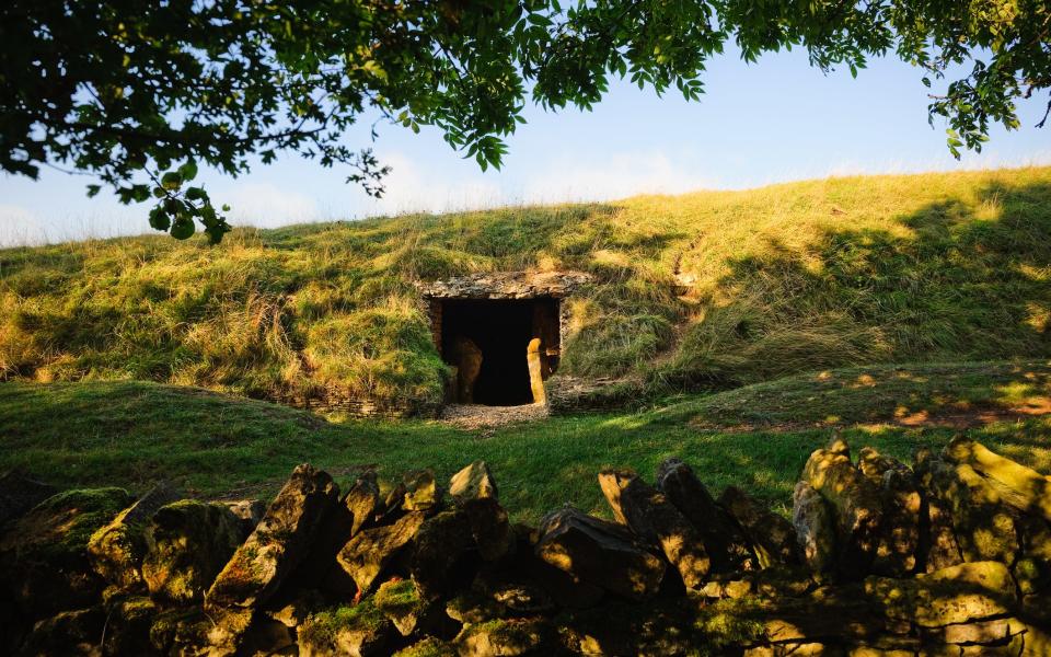
Surrounded by steep escarpments and with its own eponymous walking trail, Winchcombe is a magnet for walkers for good reason. Historic Sudeley Castle is a mile to the south-east but the stars of this walk are the Neolithic chambered tomb of Belas Knap and bleak, moody and magnificent Cleeve Common.
Follow the Cotswold Way through fields south-west of town and briefly along a lane before starting the 600ft climb to Belas Knap. Then head west to Cleeve Common with its famous Single Beech and Iron Age hill fort perched on the ‘Cotswold Edge’ with epic views reaching into Wales. Follow the path back down to Postlip and back into Winchcombe.
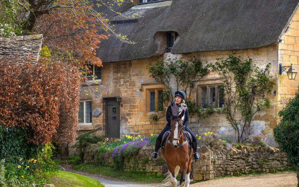
2. Stanton, Snowshill & Stanway
8 miles
Start/finish: The Mount Inn, Stanton (themountinn.co.uk)
Explorer map OL45: Grid Reference SP071342
Arguably the most beautiful Cotswold village of them all, Stanton is refreshingly free of gift shops. This delightful ‘highland’ yomp includes Snowshill (nationaltrust.org.uk) and Stanway (stanwayfountain.co.uk), both famous for their exquisite manor houses. The latter, with its superb water garden and 300ft fountain, was a favourite of Peter Pan author, JM Barrie. Along the way you’ll also see Neolithic Shenberrow Hill Fort.
Leaving ‘The Mount’, as the pub is known, follow the Cotswold Way in a U around Shenberrow Hill to where it meets the Winchcombe Way, then loop around via Buckland Wood to Snowshill. The return leg takes you through Lidcombe Wood and down the steep hill to Stanway. Finally, head north for the final leg back to Stanton along the Cotswold Way once more.
3. Broadway Tower
4½ miles
Start/finish: Crown and Trumpet Inn, Broadway (crownandtrumpet.co.uk)
Explorer map OL45: OS Grid Reference SP094374
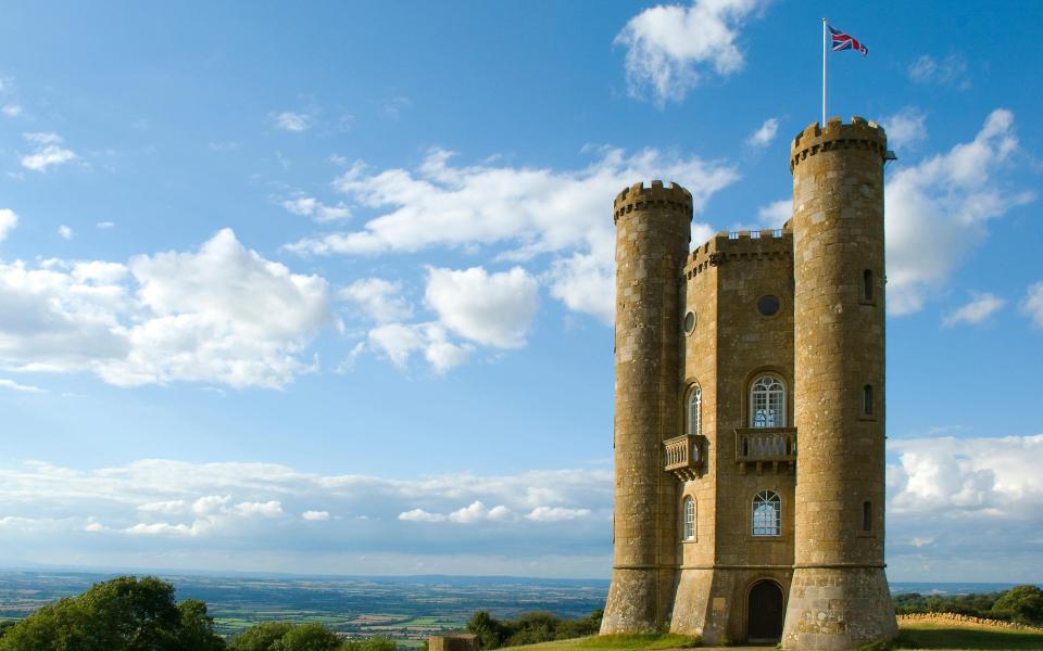
A Cotswolds classic for a very good reason, the village of Broadway was ‘discovered’ by the Victorian artistic elite in the 1870s and has been adorning calendars and biscuit tins ever since. The walk centres on Broadway Tower Country Park to the south-east and its eponymous tower, a late 18th-century folly boasting views across 13 (some say 16) counties.
From the delightfully eccentric pub, head up Church Street to the war memorial and right along the High Street. You are now on The Cotswold Way (CW). Follow the CW Acorn signs up the 700ft climb to Broadway Tower which has a William Morris Room and refreshments. Loop back along Coneygree Lane turning right (north) at 11th-century St Eadburgha’s Church and back to the village.
4. Bourton-on-the-Hill & Batsford Arboretum
7 miles
Start/finish: Horse and Groom, Bourton-on-the-Hill (horseandgroom.info)
Explorer map OL45: Grid Reference SP174326
A walk that takes you south past Sezincote House (pronounced See-zin-kt), a Mogul-style Indian extravaganza complete with minarets and domes (sezincote.co.uk) before circling north through Moreton-in-Marsh to Batsford House, childhood home of the Mitford sisters, with its 56-acre gardens and arboretum.
Head south along the Heart of England Way past Sezincote House before turning left along the footpath towards Moreton-in-Marsh, just after Home Farm. After Moreton the Monarch’s Way takes you over open fields (which can be very boggy!) to Batsford Arboretum (batsarb.co.uk; do not miss) before rejoining the Heart of England Way again for the short return leg back to Bourton.
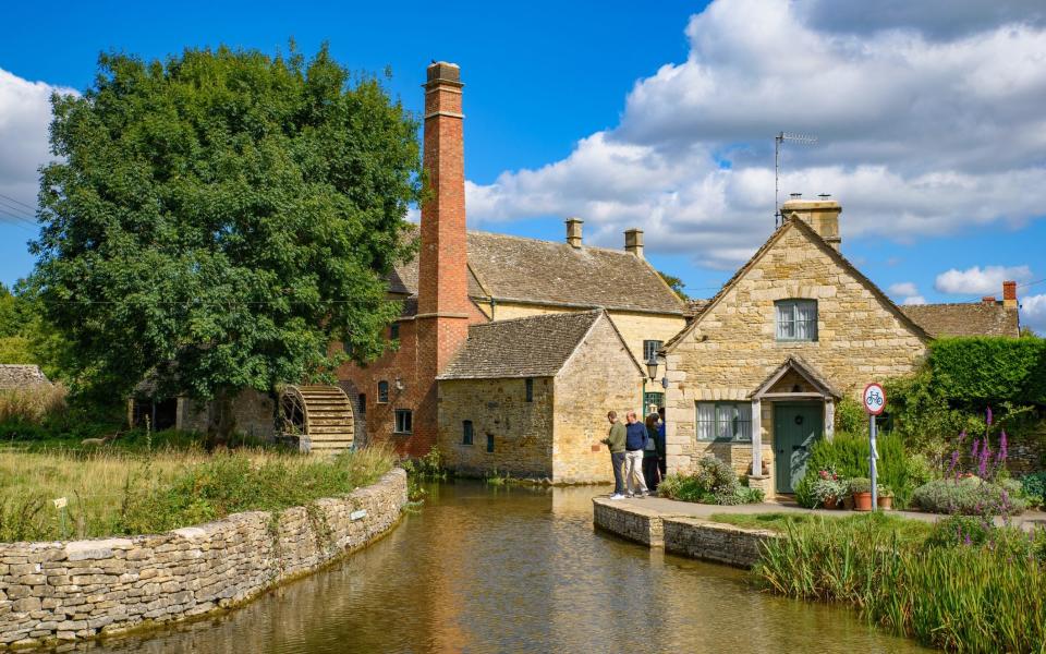
5. River Windrush & The Slaughters
7½ miles
Start/finish: Black Horse Inn, Naunton (theblackhorsenaunton.co.uk)
Explorer map OL45: OS Grid Reference SP119235
This takes you through the heart of classic, rural and village Cotswolds, and on a chilly morning, there is magic in the air. The route avoids the over-touristy Bourton-on-the-Water but includes the hopelessly picturesque Lower and Upper Slaughter, two of Gloucestershire’s most beautiful villages, and the rolling fields of the Windrush valley.
Head south at the T-junction in the centre of the village along Warden’s Way and after a mile head east, where it meets the Windrush Way and later the river itself. Cross the river at the footbridge beyond Aston Farm and then branch left along the Macmillan Way and then the Wardens Way through the Slaughters and back around to Naunton.
6. Great Tew Park
4½ miles
Start/finish: Falkland Arms, Great Tew (falklandarms.co.uk)
Explorer Map 191: Grid Reference: SP396293
The Falkland Arms is nearly half a millennium old and you would be forgiven for not wanting to leave its inglenook fireside – but you’ll regret it if you don’t. The village of Great Tew and neighbours Little Tew and Ledwell are medieval thatch-and-ironstone glories, while in between are the rolling limestone pastures, dry stone walls and fabulous views of the Great Tew Estate itself. Follow the lane (bridleway) that runs down the right side of the pub as you look at it along the border of Great Tew Park before turning directly south after about a mile. At the road turn right along the south side of the park and follow it to a footpath on your left opposite a T-junction. This heads south and then west to Little Tew and back to your start.

7. Adlestrop & Chastleton Barrow
6 miles
Start/finish: The Fox at Oddington, Lower Oddington (thefoxatoddington.com)
Explorer Map OL45: Grid Reference SP233260
History hangs heavy in the air on this walk. After the sleepy village of Adlestrop, famous for the much-loved Edward Thomas poem, comes Chastleton House, a Jacobean mansion connected to Robert Catesby of Gunpowder Plot infamy (nationaltrust.org.uk), and finally Chastleton Barrow, an Iron Age fort atop the adjacent hill. Make you way over the railway line to the signposted Macmillan Way into Adlestrop. Continue northwards up the hill into Chastleton and its Jacobean mansion. Head past the church out of the village and round the corner to the right before following a path parallel to the road which takes you to Chastleton Barrow. Follow the hill back down the other side into Adlestrop and the pub.
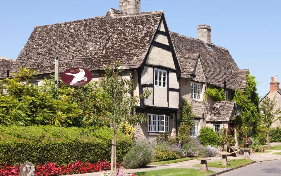
8. Minster Lovell Hall & Windrush River
4 miles
Start/finish: Old Swan, Minster Lovell (oldswan.co.uk)
Explorer Map 180: Grid Reference: SP320113
The Old Swan (gastropub and boutique hotel) is just a short walk from the 15th-century ruins of Minster Lovell Hall (english-heritage.org.uk). As atmospheric ruins go, these are up there with the best and there’s the macabre mystery of the death of one of its owners, Francis Lovell, to contemplate during the rest of the walk along the banks of the River Windrush and around through the neighbouring village of Crawley.
Turn left out of the pub and quickly right into the recreation ground which connects with a footpath that runs beside the Hall. After exploring the ruins (entry is free), stroll along the river bank, crossing the footbridges and the delightfully named Maggots Grove wild flower meadows to Crawley, then head back again on the far side of the river.
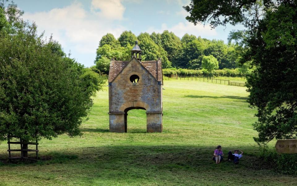
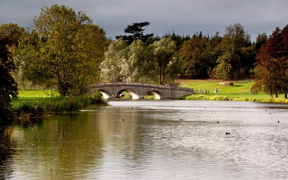
9. Blenheim Great Park
5 miles
Start/finish: The King’s Arms, Woodstock (kingshotelwoodstock.co.uk)
Explorer Map 180: Grid Reference SP445168
Blenheim Palace is not to be missed, so take this walk the long way around the Capability Brown-designed grounds. Most visitors venture no further than the vicinity of the lake and there’s really so much more to see, including the Column of Victory to the north and the delightful High Park Woods area to the south-west.
At the park entrance, take a sharp turn down the hill to the right and follow the tarmac track around the end of the lake and up over the brow of the hill to the Column of Victory commemorating the Battle of Blenheim in 1704. Then follow the footpath (there are two options) through the woods to the west and up the other side of the valley before looping around the south side of the lake and the Palace itself and back to the entrance gates (blenheimpalace.com).
10. Otmoor Nature Reserve
7 miles
Start/finish: Nut Tree Inn, Murcott (nuttreeinn.co.uk)
Explorer Map 180: Grid Reference: SP585157
A firm favourite with birders who come to see the thousands of ducks (teals and wigeons) in the reed beds of this magical reserve, brooding Otmoor looks and feels like the East Anglian fens.
From the pub, turn right along Fiveacres Road to where it takes a sharp left; here there’s a footpath on your right which takes you onto the Nature Reserve. Follow the path to Otmoor Farm and on into the centre of the moor where the path meets the Roman Road. Trace the sides of the square around the reserve and walk back to Murcott on the northern route.
For more places to stay, see our guide to the best hotels in the Cotswolds.
