
 Yahoo Movies
 Another blast of weekend winter weather expected in Nova Scotia
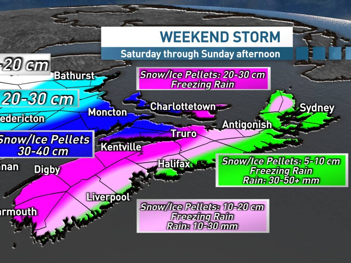
A "potentially intense" winter storm is expected to bring high winds, snow, rain, freezing rain and ice pellets to Nova Scotia this weekend.
Environment Canada issued a special weather statement for all counties in the province Thursday.
CBC meteorologist Ryan Snoddon says flurries will start Friday night and northern areas of the province could see as much as five centimetres of snow.
Those flurries will turn to steadier snow across Nova Scotia on Saturday morning as northeast winds ramp up.
As the snow turns heavy at times through Saturday morning, there will be a transition to ice pellets and freezing rain along the Atlantic coastline.
That mixing line from snow to ice, and then eventually rain, will work northward throughout the afternoon and evening hours, as northern areas see snow mixing over to ice pellets.
Power outage potential
Northeast winds, gusting 50 to more than 80 km/h, on the leading edge of the system, will lead to blowing and drifting snow and the risk of power outages, especially with the freezing rain potential.
Another round of gusty southerly winds, shifting to northwest and then west are expected late Saturday into Sunday as the centre of the storm moves through the region. As the storm departs, any icy precipitation and rain will transition to flurries as the temperatures fall on Sunday.
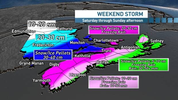
For now, five to 10 centimetres of snow is projected for the Halifax region.
In the Annapolis Valley, the amount of ice pellets mixing with snow will be key to the amount of snow that falls.
Cape Breton and the Eastern Shore could see the most rainfall, amounts near 50 millimetres. The frozen ground will increase the risk of localized flooding.
MORE TOP STORIES

