
 Yahoo Movies
 All of southwest B.C. under flood watch as 3rd consecutive storm rolls through
THE LATEST:
A flood warning is in place for the Coldwater, Nicola, Tulameen, Similkameen,Spius, Coquihalla, Chilliwack and Sumas Rivers, as well as for Lower Fraser River tributaries and for the Sumas Prairie.
The last of three major storms is pounding southwest B.C. with heavy rain as flood-ravaged communities brace for potential evacuations and damage.
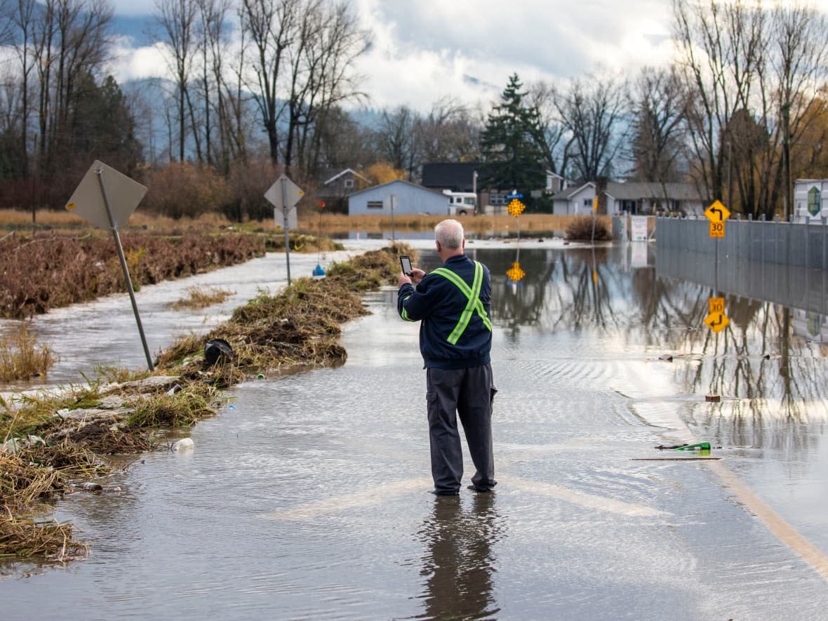
Much of the province is under either a flood watch or flood warning advisory. A flood watch means river levels are rising and may exceed their banks and flood adjacent areas. A flood warning means river levels have exceeded or will exceed their banks, and nearby areas will flood as a result.
Much of Southwest B.C. is currently under flood warning, with flood-soaked regions like the Fraser Valley and the Nicola Valley east of Vancouver set to receive up to 100 millimetres of rain, while snow is also expected at higher elevations.
The impact from the rain is expected to be worse due to extensive damage from previous storms. The biggest, which struck the province from Nov. 13 to 15, led to landslides and rainfall records being broken, while another two before and during the weekend led to renewed evacuation orders and highway closures.
B.C. Safety Minister Mike Farnworth, in a Wednesday morning news conference, stressed that people need to be prepared if they live in a flood zone and that they should stay off roads in affected areas unless absolutely necessary.
"I want to make it clear to everyone this storm is not yet over," he said.
Evacuation orders remain in place for hundreds of properties in southwest B.C. The current storm system affecting the province hit the Central Coast first before travelling south, leading to more evacuation orders in areas north of the Fraser Valley region and Metro Vancouver.
This includes the communities of Hope, Mission, and Hatzic in the eastern Fraser Valley. Some residents of Maple Ridge, just east of Vancouver, had warnings delivered to them due to potential floods.

Residents forced to flee floodwaters mid-month also remain away from their homes in B.C.'s Interior, including in Princeton and Merritt.
Transport Canada has temporarily restricted non-essential marine traffic on B.C. waterways in certain flooded areas, including sections of the Fraser, Coldwater and Similkameen rivers.
Nearly all of the province is also at a high or extreme risk of avalanche due to warming temperatures, with the greatest dangers in places like the Sea to Sky region north of Vancouver, the northwest coast and the northern Rockies.
But there was cautious optimism from officials in areas badly hit by flooding that the worst was over.
Abbotsford Mayor Henry Braun said on Wednesday that water levels would continue to subside over the coming days in the city, even as rainwater and snow melt led to more water making its way into the city from south of the Canada-U.S. border.
The rising water levels on the Fraser River led to the city closing floodgates at the Barrowtown Pump Station.
Barrowtown is a vital piece of infrastructure keeping water from filling up the low-lying Sumas Prairie area, which has already been battered by floods.
"[Closing the floodgates] means that the level of the Sumas River will begin to rise, but don't panic. That's that's how they're designed," he said at a news conference.
"We do not anticipate that this will cause any issues. We expect to be able to reopen the floodgates later [Wednesday] when the tide drops."
WATCH | Rain subsides in B.C., but snow melt is the new concern:
Highway closures and choked supply chain
A number of highways remain closed or under travel advisory because of the impact of previous floods and mudslides.
Highway 3 from Hope to Princeton is open for essential travel only. However, on Wednesday flooding east of Princeton forced a closure between Taylor Way and Old Hedley Road. There is no detour for commercial vehicles, but light vehicles may navigate around the closure using Old Hedley Road.
Highway 99 between Pemberton and Lillooet was closed again on Wednesday due to a mudslide after initially reopening only for essential traffic. The stretch saw a mudslide that left four people dead and one missing during the mid-November storm.
The stretch of the Trans-Canada Highway (Highway 1) between Abbotsford and Chilliwack, crucial for connecting Metro Vancouver and the rest of the province, remains closed.
There is also a travel advisory for Highway 20 in the Bella Coola Valley area on the Central Coast.
Though Highway 3 between Hope and Princeton has been reopened, allowing for commercial vehicles and other essential travel, the storm has choked the province's supply chain.

Dave Earle, president of the B.C. Trucking Association, said Tuesday it is taking truckers "more than double the time" to get goods from one point to another in the province.
Tuesday also saw the announcement of a potential strike by container truck drivers serving the Port of Vancouver, and continuing impacts on railway lines.
Canadian National (CN) said on Monday it had stopped some of its rail service along the southern B.C. freight corridor because the rain caused increased debris, washouts and landslides.
CN diverted some rail traffic to the Port of Prince Rupert, but both northbound and eastbound traffic to and from Vancouver were still affected.
Fuel rationing is also set to remain in place in B.C. until at least Dec. 14.


